You are here About GIS technology Esri map gallery Esri map gallery Have a look at these GIS maps from around the world and see how other users are sharing information via smart mapping technology. Select an industry All industriesAgriculture and plantationHealth and human servicesSpatial data infrastructureNon-profitManufacturingUtilitiesTransportation and logisticsTelecommunicationsRetailProperty and real estateMining and petroleumLand administrationBanking and financial servicesInfrastructure and public worksGovernmentGasForestryEmergency and disaster responseElectricityDefence and intelligenceWater Select a region All regionsAfricaSouth AmericaNorth AmericaAsiaAustraliaEuropeInternational Select a subject All subjectsNatureDisasterIn the newsBusinessCultureCommunityDesignDevelopmentFarmingHistoricalHumanitarianUrban planningTravelPoliticsSpaceScienceTechnologyVirtual reality Flying high in the Indonesian sky Follow Saleh Sudrajat's 5,000-kilometre journey across Indonesia - from Sabang to Merauke - in an ultralight trike that could facilitate access to disaster areas and expediate emergency service delivery across the nation. Explore Get to know Marvel's superheros Explore the origins of the mighty men and women of Marvel Comics who wreak havoc, exact revenge, rescue the helpless and defend the downtrodden. Explore Growth from the ground up Learn more on the importance of green infrastructure amid today's urban developments, and discover how communities stand to benefit from reversing the traditional order of planning. Explore MH370 one year on: what we know A year on from the disappearance of Malaysia Airlines flight MH370, this interactive story map follows the timeline of events and the steps being taken by authorities to solve the mystery. Explore MudiKuy! 2019 Three Indonesian undergraduates explore how Esri's solutions can tackle local transportation woes during the holidays, as well as monitor and optimise plant growth and fertility. Explore Outcomes of an internship with Esri Indonesia Walk through the six-week internship with Esri Indonesia undertaken by five university students and see how their exposure to real-world situations has resulted in a valuable working experience for them. Explore Public health preparedness When public health is threatened, public health professionals and agencies need to respond quickly and make timely decisions that will improve overall health security and minimise consequences. Explore Sea tourism in Indonesia Drift among the 17,000 islands that lay at the heart of the world-renowned 'coral triangle', and learn about the most beautiful aquatic locations in Indonesia. This map makes it easy to plan for your next vacation! Explore Singapore OneMap Developed by the Singapore Land Authority, the Singapore OneMap is an application that allows users to search and navigate intelligently for places of interest such as museums, hawker centres, childcare services, parks and sports centres. Explore Pagination First page « First Previous page ‹ Previous Page 1 Current page 2 Page 3 Page 4 Next page Next › Last page Last »
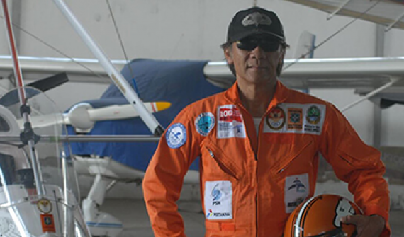
Flying high in the Indonesian sky Follow Saleh Sudrajat's 5,000-kilometre journey across Indonesia - from Sabang to Merauke - in an ultralight trike that could facilitate access to disaster areas and expediate emergency service delivery across the nation. Explore
Get to know Marvel's superheros Explore the origins of the mighty men and women of Marvel Comics who wreak havoc, exact revenge, rescue the helpless and defend the downtrodden. Explore
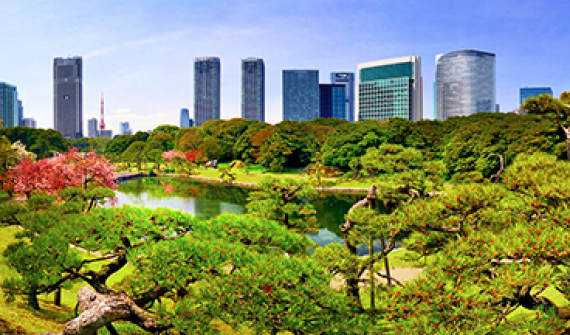
Growth from the ground up Learn more on the importance of green infrastructure amid today's urban developments, and discover how communities stand to benefit from reversing the traditional order of planning. Explore
MH370 one year on: what we know A year on from the disappearance of Malaysia Airlines flight MH370, this interactive story map follows the timeline of events and the steps being taken by authorities to solve the mystery. Explore
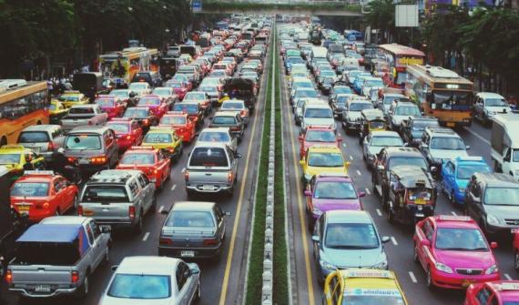
MudiKuy! 2019 Three Indonesian undergraduates explore how Esri's solutions can tackle local transportation woes during the holidays, as well as monitor and optimise plant growth and fertility. Explore
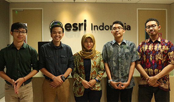
Outcomes of an internship with Esri Indonesia Walk through the six-week internship with Esri Indonesia undertaken by five university students and see how their exposure to real-world situations has resulted in a valuable working experience for them. Explore
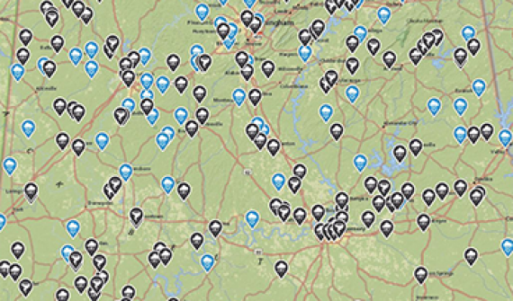
Public health preparedness When public health is threatened, public health professionals and agencies need to respond quickly and make timely decisions that will improve overall health security and minimise consequences. Explore
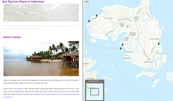
Sea tourism in Indonesia Drift among the 17,000 islands that lay at the heart of the world-renowned 'coral triangle', and learn about the most beautiful aquatic locations in Indonesia. This map makes it easy to plan for your next vacation! Explore
Singapore OneMap Developed by the Singapore Land Authority, the Singapore OneMap is an application that allows users to search and navigate intelligently for places of interest such as museums, hawker centres, childcare services, parks and sports centres. Explore