The DKI Jakarta Provincial Government's Smart City Program "Jakarta Satu" is a successful initiative that is referred to as a benchmark for best practice for other cities in the surrounding area. Co-developed with Esri Indonesia, Indonesia's leading provider of geospatial solutions, Jakarta Satu enables the digital transformation of the city of Jakarta by facilitating the integration of spatial information from all work units in the capital region.
The Department of Human Settlements, Spatial Planning, and Land Affairs of DKI Jakarta builds city maps using Geographic Information System (GIS) technology to integrate, analyze, and disseminate spatial data that can be utilized to serve the interests of the community.
This technology is designed to improve the management of DKI Jakarta's five pillars: Social and Population, Taxation, Asset Spatial Planning, Licensing and Environment, Building and Land and is designed to encourage smarter government services to ensure that Jakarta's development can make the lives of its citizens better today and in the future.
Data from work units such as groundwater maps from the Jakarta Spatial Planning Agency, tax and retribution statistics from the Regional Tax and Retribution Management Agency, details of city assets from the Jakarta Financial Management Agency, and population data from the Population and Civil Registry Office will be integrated to empower leaders to make well-informed decisions. By using the Jakarta Satu system, a collaboration between related institutions will be created and will increase the effectiveness of work that has been transformed from a manual system to digitalization.
Through this system, the policies and initiatives can be carried out consistently based on authoritative data and information. The map and data information will be updated regularly by each working unit to ensure accuracy of information.
Under the country’s principle of 'One Map, One Data, One Policy' the real-time insights derived from Jakarta Satu will improve workflows and connect people, networks, applications, and devices — all in real-time, with continuous reliability and security. More importantly, Jakarta Satu is also a tool to prevent corruption and promote clean and good governance as it allows 10.3 million citizens of Jakarta to easily access spatial data anywhere using any device.
“Data and information are the foundation of every smart city. How well you use it will greatly affect how well the city is managed and developed. Jakarta Satu is an advancement in GIS that opens new horizons for urban planners, communities and businesses,” said Christanto Yanuar, Country Manager for Esri Indonesia.
"We will continue to support Jakarta Satu to utilize the latest geospatial technology such as mapping using the GeoAI method in all aspects or visualization in 3D form so that DKI Jakarta will be able to provide smarter public services, make wiser policies based on data, and manage activities," he said. day-to-day operations more efficiently,” continued Chris.
Jakarta Satu will also be a tool for the Provincial Government in driving the Industrial Revolution 4.0 (fourth generation) because it aims to build high-quality maps and databases that can be used as a basis for facilitating ways to handle community feedback and providing new insights on the most important topics. Spatial data available in Jakarta Satu can be easily accessed through the website by the public, so there is no need to come to the official office.
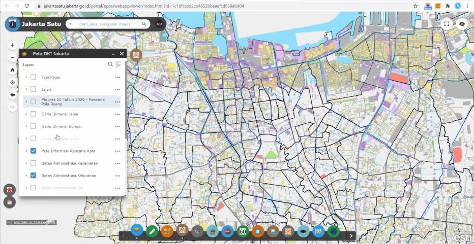
For example, Chris mentioned how this pandemic poses new challenges for the Jakarta city government, government employees, and citizens. Work processes and resources need to be digitized and the speed and availability of data access needs to be increased. Through Jakarta Satu, City Planning Information (IRK) can also be accessed by the public digitally to obtain information about city plans. Jakarta Satu has also been integrated with BPN where the public can directly view their map data and synchronize it with the city plan accurately.
“Data governance is very important. For us, there is a real opportunity to use data to make smarter policy decisions and certainly it will increase public trust. We know that it’s important to listen and be transparent in doing smart public services —but in a city as large as Jakarta, the sheer number of requirements and messages makes it impossible to respond fast enough if you are handling every message manually. We wanted to find a way to process feedback more quickly, analyze and prioritize the most important issues. Jakarta Satu is an example of a change towards systematic good governance that we are starting. With Jakarta Satu, data from all working units will be integrated and can be accessed directly by the DKI Jakarta Provincial Government in a single base map," said Heru Hermawanto, Head of Department of Spatial Planning and Land Affairs, DKI Jakarta.
“We are proud to partner with Esri Indonesia and embrace the smart city technologies and together we will improve the quality life of Jakarta’s citizen," concluded Hermawanto.
Jakarta Satu recently won the award as the Best Geospatial Network Node at the Bhumandala Award for succeeded in developing and implementing innovations in the use of Geospatial Information.
The provincial government of Jakarta also presented its best practice with a Smart City event “Connected Cities 4.0” forum to share their experience on how geospatial technology is driving the next generation of e-government services amidst the new normal.
To get more info about Jakarta Satu please visit jakartasatu.jakarta.go.id