The Ministry of Public Works and Housing (MPWH) and Telkomsel are considered to have pushed Indonesia's digital transformation to a new level through innovative geospatial technology (smart mapping).
Both are pioneering data optimization with the support of digital mapping technology, which streamlines and broadens data access across teams to create efficient workflows.
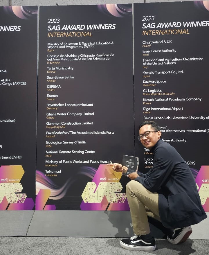
For this achievement, the Ministry of Public Works and Housing and Telkomsel are considered to have pushed Indonesia's digital transformation. The Ministry of Public Works and Housing and Telkomsel each won the Esri SAG Award - a special award for the use of Geographic Information Systems (GIS) technology selected from hundreds of thousands of organizations world-wide - at the Esri User Conference in San Diego, United States.
Esri is a provider of GIS technology, which enables governments and corporate entities to leverage location-based data analytics, to drive operational efficiencies and facilitate data-driven and evidence-based decision making.
"Data optimization is a priority for the government and business people in the digital era. The Ministry of Public Works and Housing and Telkomsel are two of the most progressive institutions in the use of geospatial technology for the benefit of public services," said Esri Indonesia President Director Leslie Wong.
According to Leslie, mapping the data layer visualized with location analytics on digital maps allows teams of technical and non-technical workers to have conversations, which have not been explored before. These suites establish new workflows that save time and resources.
"The Ministry of Public Works and Housing and Telkomsel set the highest benchmark in the future, how data is integrated to meet goals in a more transparent and easy-to-understand format. They excel in leading digital transformation in Indonesia through innovation in government, telecommunications and construction," he said.
The two award-winning projects highlight how government agencies and businesses can use GIS technology to predict challenges and pivot resources to meet deadlines, said Esri Indonesia Solution Strategist Manager Khairul Amri.
“The ability to record and forecast with a single source of real-time truth is an integral part of project management and cuts through siloes. A direct result of these visualisations is that solutions are designed with a more timely and coordinated approach,” Amri said.
The Ministry of Public Work and Housing innovates by developing maps that use GIS technology and building information management (BIM) technology as a single source of truth.
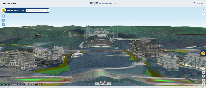
This platform has successfully monitored more than 70 projects, ranging from roads, dams and buildings, as well as the construction of the Archipelago's New Capital City (IKN) in East Kalimantan.
Stakeholders including contractors, project owners, management and government regulators can take advantage of this platform to ensure project progress in real time, so that collaboration can run smoothly throughout Indonesia.
The Secretary General of the Ministry of Public Works and Housing, Mohammad Zainal Fatah said, in the past the construction sector faced big challenges with the existence of compartmentalized data and complex file management. This hampers the collaboration process and interferes with productivity.
"The Ministry of Public Works and Housing devotes energy to this innovative approach so that we can take advantage of geospatial technology, which allows the building of an interconnected data environment. This platform improves workflow across departments and allows us to collaborate as a team in the development of IKN," he said.
He added that it was an honor to confer the Esri SAG Award, because it shows that the Ministry of Public Works and Housing has the highest capabilities and standards on the global stage.
Geospatial technology and BIM play an important role in the success of Ministry of Public Works and Housing projects. This technology supports spatial data analysis in modern telecommunication infrastructure, which is very important for the communication, trade and information access sectors.
As a digital telecommunications company, Telkomsel provides digital connectivity, digital platforms, and digital services by incorporating the latest technology for the progress of every aspect of society's lives. The utilization of geospatial technology helps map network quality to serve a more evenly distributed population, especially indoors. Telkomsel is committed to delivering world-class innovative digital services and solutions that exceed users' expectations with the support of broader implementation of 4G/LTE and 5G broadband network technologies.
"We appreciate the Esri SAG Award recognition, which demonstrates Telkomsel's commitment to continuously innovate in providing the best services to customers. In the future, Telkomsel will continue to develop the coverage of digital services through the utilization of advanced analytics, including geospatial technology," said Hardika Nugroho, Vice President of Advanced Analytics and Growth Marketing at Telkomsel.
Telkomsel currently serves more than 151 million customers spread across even the most remote and outermost regions of Indonesia, with the support of over 258,000 BTS (Base Transceiver Stations).
This award also shows the contribution of the Ministry of Public Works and Housing and Telkomsel as pioneers in adopting location analytics in Indonesia.
If you would like more details or to have any questions answered by the media team, contact Martin Volz, Senior PR and Communications Advisor, by email.