

Whether you're an operations manager who needs to see the location of assets or a market analyst interested in understanding consumer profiles in a targeted region, you can use ArcGIS Apps for the Office to make decisions that save money and time. Visualise your data in a geographic context and gain location-based insights that you would otherwise miss.
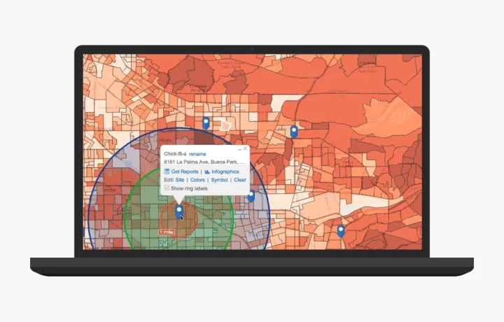
Find the right site for your business
Map your target customers, sales territories and potential sites. Combine them with demographic, lifestyle and spending data. Assess market feasibility and consumer profile for potential business sites and gain the business insights you’ve been missing. Find the sites that match your target market criteria and are most likely to be profitable.
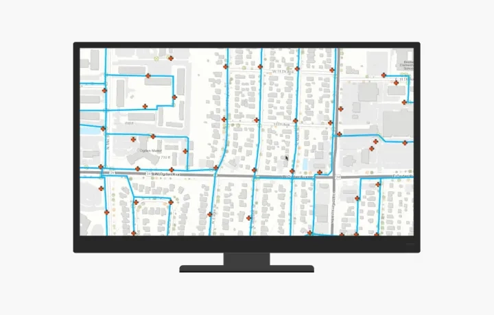
Optimise your asset management
Map your assets, network, infrastructure and work orders to learn how they are interconnected. Augment with weather, topography, satellite imagery and field data. Know more about asset performance and personnel productivity. For example, identify customers affected by a broken water-line and trace the assigned work order. Get a real-time view of asset performance, maintenance history and inspections. Improve resource planning and reduce enterprise asset management operating costs.
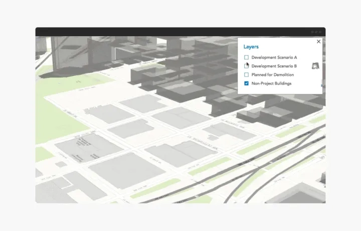
Review and evaluate planning scenarios
Create realistic context and visualise your urban plans, architecture and designs in 3D. Understand where a proposed building blocks the view, casts shadows and reflects heat. Determine how a building proposal and its alternative scenarios fit into your city’s overall vision.
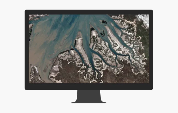
Monitor land use change
From understanding forest destruction and habitat loss to disaster response and environmental impact studies, you get the best visual context from satellite and drone-captured imagery. Visually compare your area of interest over time and quantify land use change. Perform analysis to extract more meaning. Use met data to know more about the imagery. Assess the impact of environmental changes and urban growth. Improve forestry management and operations. Know where to send emergency response crews. Manage vegetation encroachment.
For more information on ArcGIS apps for the office, get in touch with us on email or call (021) 2709 9881 - 84.
Find the right app
Start making better decisions using any of these apps. Most of them come included with ArcGIS.
ArcGIS Pro
The latest addition to ArcGIS for Desktop. Create 2D and 3D maps. Edit and analyze data faster using a new, high-performance 64-bit architecture.
Operations Dashboard
A configurable web app that provides location-aware data visualisation and analytics for a real-time operational view of people, services, assets, and events.
ArcGIS Insights
Interactively explore and analyze your data - from ArcGIS source, Excel spreadsheets, big data and more - all in one experience.
Business Analyst for ArcGIS
Combine demographic, lifestyle, and spending data with map-based analytics for accurate reports and dynamic presentations.
Esri CityEngine
The advanced 3D city design application for creating, editing, and sharing 3D building models and massive urban environments.
Drone2Map for ArcGIS
Streamline the creation of professional imagery for visualisation and analysis in ArcGIS.

ArcGIS Earth
Explore the world with this interactive globe, Display 2D and 3D map data, including KML, and sketch placemarks to understand spatial information.