You are here About GIS technology Esri map gallery Esri map gallery Have a look at these GIS maps from around the world and see how other users are sharing information via smart mapping technology. Select an industry All industriesAgriculture and plantationHealth and human servicesSpatial data infrastructureNon-profitManufacturingUtilitiesTransportation and logisticsTelecommunicationsRetailProperty and real estateMining and petroleumLand administrationBanking and financial servicesInfrastructure and public worksGovernmentGasForestryEmergency and disaster responseElectricityDefence and intelligenceWater Select a region All regionsAfricaSouth AmericaNorth AmericaAsiaAustraliaEuropeInternational Select a subject All subjectsNatureDisasterIn the newsBusinessCultureCommunityDesignDevelopmentFarmingHistoricalHumanitarianUrban planningTravelPoliticsSpaceScienceTechnologyVirtual reality Dashboard creation for monitoring Conservation Area Monitoring Conservation Areas for Sustainable Palm Oil Industry using Arc GIS app Explore Standby areas for efficient rig operations Discover how Pertamina Hulu Mahakam approaches rig move planning, ensuring safe, accessible standby areas and efficient operations. Explore Modern, connected geological mapping Explore the StoryMaps to see how ArcGIS Pro and Datamine Discover Mobile deliver flexible, real-time, and internet-independent workflows for accurate, efficient geological mapping and sampling. Explore Spatial Deep Learning for Geotechnical: HK's Approach on Underground Challenges Ensuring Safe and Secure Spatial Data through Integrated Geotechnical Survey Monitoring Explore JORC Code Resource Polygon Automation & Field Coal Quality Data Monitoring from Near Real-Time Data Resource Polygon Auto-Generator for JORC Code Resource Estimation & Field Coal Quality Data Monitoring Explore Investing in Spatial Ways: The Key to Jakarta's Future Dengan kemajuan pesat pada teknologi GIS, DPMPTSP berupaya mengidentifikasi lokasi yang ideal bagi para calon investor di DKI Jakarta. Explore Weather Information System Portal (CIWIS) for Citarum River Interns from Bandung Insitute of Technology created CIWIS (Citarum Weather Information System) a web portal for weather information and flood simulation along the Citarum River. Explore MudiKuy! 2019 Three Indonesian undergraduates explore how Esri's solutions can tackle local transportation woes during the holidays, as well as monitor and optimise plant growth and fertility. Explore Public health preparedness When public health is threatened, public health professionals and agencies need to respond quickly and make timely decisions that will improve overall health security and minimise consequences. Explore Pagination Current page 1 Page 2 Page 3 Page 4 Page 5 Next page Next › Last page Last »
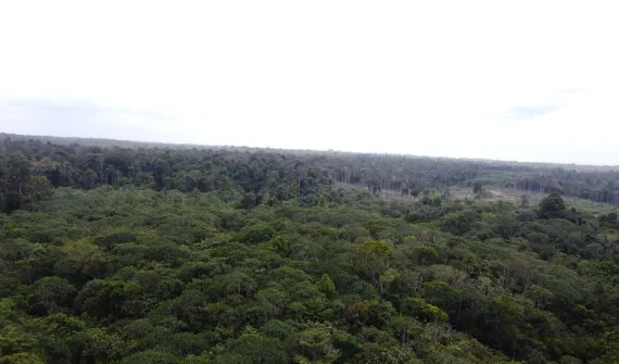
Dashboard creation for monitoring Conservation Area Monitoring Conservation Areas for Sustainable Palm Oil Industry using Arc GIS app Explore
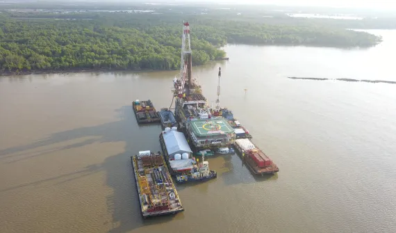
Standby areas for efficient rig operations Discover how Pertamina Hulu Mahakam approaches rig move planning, ensuring safe, accessible standby areas and efficient operations. Explore
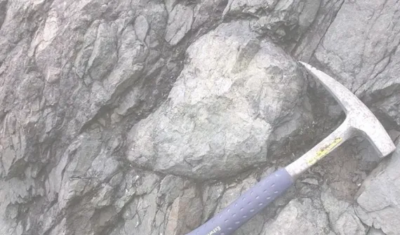
Modern, connected geological mapping Explore the StoryMaps to see how ArcGIS Pro and Datamine Discover Mobile deliver flexible, real-time, and internet-independent workflows for accurate, efficient geological mapping and sampling. Explore
Spatial Deep Learning for Geotechnical: HK's Approach on Underground Challenges Ensuring Safe and Secure Spatial Data through Integrated Geotechnical Survey Monitoring Explore
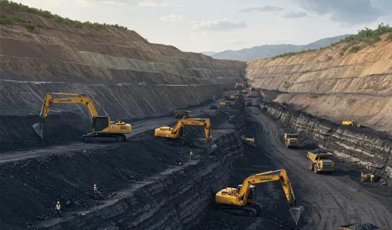
JORC Code Resource Polygon Automation & Field Coal Quality Data Monitoring from Near Real-Time Data Resource Polygon Auto-Generator for JORC Code Resource Estimation & Field Coal Quality Data Monitoring Explore
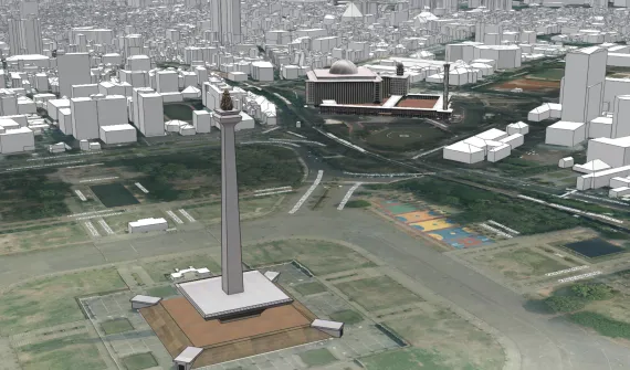
Investing in Spatial Ways: The Key to Jakarta's Future Dengan kemajuan pesat pada teknologi GIS, DPMPTSP berupaya mengidentifikasi lokasi yang ideal bagi para calon investor di DKI Jakarta. Explore
Weather Information System Portal (CIWIS) for Citarum River Interns from Bandung Insitute of Technology created CIWIS (Citarum Weather Information System) a web portal for weather information and flood simulation along the Citarum River. Explore
MudiKuy! 2019 Three Indonesian undergraduates explore how Esri's solutions can tackle local transportation woes during the holidays, as well as monitor and optimise plant growth and fertility. Explore
Public health preparedness When public health is threatened, public health professionals and agencies need to respond quickly and make timely decisions that will improve overall health security and minimise consequences. Explore