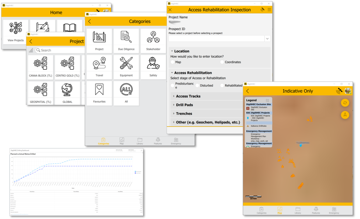
What has 60+ survey forms, maps, pdf's, automated workflows and dashboards; is digitally transforming safety, health, environment and community (SHEC); and won three awards in 2023? DigiSHEC.
OZ Minerals (now a BHP Company), like many mining operators, mitigates risk to eliminate unnecessary harm and maximize worker safety throughout its exploration project lifecycles. While the organization had rigour around reporting and due diligence in assessing new partners and collating critical safety information, much of it was recorded individual spreadsheets then squirreled away.
DigiSHEC digitally transformed the way information was collated into a single repository, making all data points available in dynamic reporting or used in semi-automated workflows.
This not only made delivery of information faster and more consistent, but by digitizing the key metrics to track staff, community or partners it also ensured adherence to the exploration project lifecycle.
DigiSHEC — built on ArcGIS Online and leveraging its strong data management principles — was simple in design yet powerful in producing:
- 60+ Survey123 forms.
- Groups to securely deliver data, forms and maps to different project teams.
- Scheduled Notebooks to process look up tables from datasets, the creation of projects and user management.
- Power Automate to process PDF’s of emergency management and technical work plans.
- Dashboards to showcase drilling details.
After investigating a number of turnkey systems, we found that like many out-of-the-box (OTB) solutions were not flexible enough to meet our requirements or they were so big and expensive they were priced out.

Esri’s cross platform technology, ArcGIS AppStudio, reduced development time (and cost) on delivering to Android, Apple and Windows devices.
As part of the data design all forms are pre-populated with the relevant Project ID through the selection of projects in the UI therefore, all data can be linked back to the project for reporting. This means we made use of referential databases (Parent/Foreign Key) while producing loosely coupled feature layers (datasets).
As a collaborative effort between GP One Consulting and Esri Australia, the application delivered intuitive, easy-to-use survey forms with a project-based contextual UI for geologists, making data collection and management easier. Offline capabilities in the forms, maps and supplementary documents — such as emergency plans — meant staff were confident they could access their plans from anywhere.
DigiSHEC also proved to be an enabler across the board; staff could prototype their own forms — which created buy-in and made the applications more collaborative and distributed the responsibility for application support among multiple stakeholders, not just IT.
It helps that BHP (Oz Minerals) already have user licensing and able to leverage existing resources, but the advantage was that the system could be shared to any other global organization using ArcGIS Online — such as their Brazilian counterparts.
In hindsight, this was one of the best implementations I’ve worked on not just because it delivered an innovative yet practical solution, but because it created a mindset shift across the team — so much so that it won in three awards at the 2023 Geospatial Excellence Awards in South Australia for: Environment & Sustainability, Geospatial Enablement, and Technical Excellence.
If you would like assistance with configuring your ArcGIS application, get in touch with Esri Indonesia solutions team.
