You're viewing the English translation
Esri Indonesia | Home

Main navigation

  • Industries
    • Commercial
      • Architecture, engineering and construction
      • Banking and financial services
      • Electricity
      • Forestry
      • Manufacturing
      • Market development
      • Media
      • Mining
      • Oil & gas
      • Plantation
      • Property and real estate
      • Retail
      • Telecommunications
      • Transportation and logistics
      • Water
    • Government
      • Solutions for government
      • Cities and municipalities
      • Defence and intelligence
      • Emergency and disaster response
      • Maritime and hydrography
      • Infrastructure and public works
      • Land administration
      • National government
      • Provincial government
      • Spatial data infrastructure
    • Community
      • GIS for schools
      • Fellowship Program
      • Fellowship Program Hall of Fame
      • Esri Young Scholar Award
      • Non-profit
  • Products
    • Capabilities
      • Digital twins
      • Field operations
      • Imagery and remote sensing
      • Real-time visualisation and analytics
      • Spatial analytics
    • About ArcGIS
      • ArcGIS user types
      • ArcGIS product licensing
      • ArcGIS Online
      • ArcGIS Pro
      • Migrating to ArcGIS Pro
      • ArcGIS Enterprise
      • ArcGIS Location Platform
      • ArcGIS Developer
      • ArcGIS for Personal Use
      • ArcGIS Online free trial
      • See other Esri products
    • Applications
      • Apps for the office
      • Field operations
      • Apps for the community
      • App Builders
      • LivingLab
      • NV5 Geospatial
    • Data
      • GIS data
      • Open Data
      • Data Interoperability
      • Open Standards
      • Esri’s Open Vision
  • Services and support
    • Services
      • ArcGIS maintenance program
      • Consulting services
      • Project services and application development
      • Managed services
    • Technical support
      • Esri Support App
      • Support resources
      • Support programs
      • Support request
    • Training
      • Training calendar
      • Training courses
      • GeoEnablement Portal
      • Submit a training enquiry
  • News and events
    • News
      • In the media
      • Mapping Evil with Mike King
      • Subscribe to news
    • Blogs
    • Events calendar
      • Webinars
      • Past event presentations
    • GIS Directions podcast
  • About
    • Esri Indonesia
      • Our people
      • Our history
      • Our relationship with Esri
      • Our relationship with Boustead
      • Our partner program
    • GIS technology
      • About Esri
      • Jack Dangermond
      • History of GIS
      • Location analytics
      • Esri map gallery
    • Careers
      • Internship program
      • Geospatial scholarship program
    • Contact us
      • Sales and services
      • Support request
      • Training
      • General enquiries
      • Subscribe
  • Store

You are here

  • About
  • Careers
  • Geospatial scholarship program

Geospatial Scholarship Program

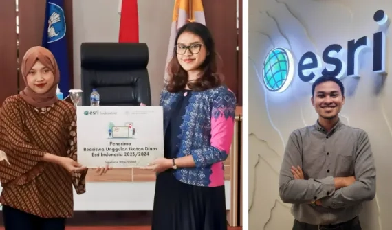
About the Esri Indonesia Geospatial Scholarship Program

Esri Indonesia Scholarship and Internship program aims to identify and nurture geospatial talent early, ensuring students are job-ready upon graduation through comprehensive training and mentorship. 

Annually, we offer two scholarships to applicants who successfully enrolled in applied science in GIS, Vocational College, Universitas Gadjah Mada (UGM).

Thumbnail SIG UGM VIdeo
Video Empowering Indonesia’s geospatial professionals

There is a rising need for skilled GIS professionals who can leverage geography to solve real-life problems. Learn more about the applied science in GIS, Vocational College, Universitas Gadjah Mada.

Prestigious fellowship program provides smart mapping tech research funding for students_banner
Resource Are you eligible?

Read about the full eligibility criteria for the Esri Indonesia Geospatial Scholarship Program and apply today.

More

For more information, visit the Applied science in GIS, Vocational College, UGM page.

Awardee of the first scholarship batch
News Awardee of the first batch on Geospatial Scholarship Program

Esri Indonesia Honors scholarship recipients for their dedication to geospatial technology education, supporting innovation and development in GIS through a science and technology partnership

Learn More

Subscribe to
Esri Indonesia news

Esri Indonesia | Home

Footer menu

  • Sitemap
  • Privacy
  • Website Terms and Conditions

© 2025 Esri Indonesia All rights reserved.