You're viewing the English translation
Esri Indonesia | Home

Main navigation

  • Industries
    • Commercial
      • Architecture, engineering and construction
      • Banking and financial services
      • Electricity
      • Forestry
      • Manufacturing
      • Market development
      • Media
      • Mining
      • Oil & gas
      • Plantation
      • Property and real estate
      • Retail
      • Telecommunications
      • Transportation and logistics
      • Water
    • Government
      • Solutions for government
      • Cities and municipalities
      • Defence and intelligence
      • Emergency and disaster response
      • Maritime and hydrography
      • Infrastructure and public works
      • Land administration
      • National government
      • Provincial government
      • Spatial data infrastructure
    • Community
      • GIS for schools
      • Fellowship Program
      • Fellowship Program Hall of Fame
      • Esri Young Scholar Award
      • Non-profit
  • Products
    • Capabilities
      • Digital twins
      • Field operations
      • Imagery and remote sensing
      • Real-time visualisation and analytics
      • Spatial analytics
    • About ArcGIS
      • ArcGIS user types
      • ArcGIS product licensing
      • ArcGIS Online
      • ArcGIS Pro
      • Migrating to ArcGIS Pro
      • ArcGIS Enterprise
      • ArcGIS Location Platform
      • ArcGIS Developer
      • ArcGIS for Personal Use
      • ArcGIS Online free trial
      • See other Esri products
    • Applications
      • Apps for the office
      • Field operations
      • Apps for the community
      • App Builders
      • LivingLab
      • NV5 Geospatial
    • Data
      • GIS data
      • Open Data
      • Data Interoperability
      • Open Standards
      • Esri’s Open Vision
  • Services and support
    • Services
      • ArcGIS maintenance program
      • Consulting services
      • Project services and application development
      • Managed services
    • Technical support
      • Esri Support App
      • Support resources
      • Support programs
      • Support request
    • Training
      • Training calendar
      • Training courses
      • GeoEnablement Portal
      • Submit a training enquiry
  • News and events
    • News
      • In the media
      • Mapping Evil with Mike King
      • Subscribe to news
    • Blogs
    • Events calendar
      • Webinars
      • Past event presentations
    • GIS Directions podcast
  • About
    • Esri Indonesia
      • Our people
      • Our history
      • Our relationship with Esri
      • Our relationship with Boustead
      • Our partner program
    • GIS technology
      • About Esri
      • Jack Dangermond
      • History of GIS
      • Location analytics
      • Esri map gallery
    • Careers
      • Internship program
      • Geospatial scholarship program
    • Contact us
      • Sales and services
      • Support request
      • Training
      • General enquiries
      • Subscribe
  • Store

You are here

  • Industries
  • Community
  • Non-profit

GIS in non-profit

Not for profit banner illustration

Access data, technology, and resources to advance your mission.

Enabling a smarter world video
Video Enabling a smarter world

Location intelligence has guided the most successful sustainability projects in the last two decades. Listen to what its advocates say.

More
Shrinking the Distance to Food Aid news
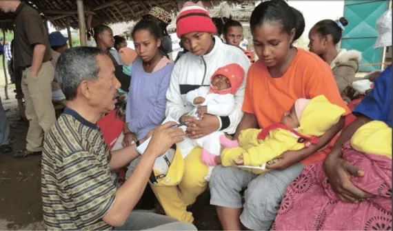
News Shrinking the Distance to Food Aid

USAID used predictive analysis tools to optimise food distribution sites, minimising the distances women and children travel to receive aid.

More

Click on this link to apply for the Esri non-profit Organisation Program

Refugee influx story map
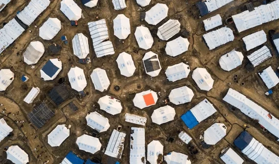
Story map Refugee influx

Maps and charts put the Rohingya refugee crisis, one of the fastest growing refugee crises in recent decades, in sharp perspective.

More
Plant for the planet video
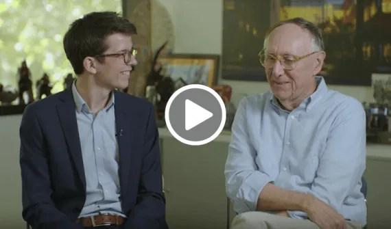
Video Plant for the planet

Esri President Jack Dangermond and Plant-for-the-Planet Founder, Felix Finkbeiner, discuss practical solutions to counteracting climate change.

More
Hot spots of forest loss
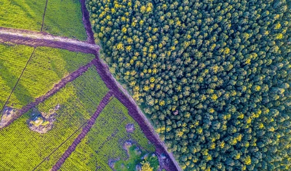
Story map Hot spots of forest loss

As the global demand for food demand rises, agriculture is expanding into tropical forest landscapes to produce more beef, timber, palm oil and soy and other agricultural commodities. Can data analysis protect the world's remaining forests? 

More

Subscribe to
Esri Indonesia news

Esri Indonesia | Home

Footer menu

  • Sitemap
  • Privacy
  • Website Terms and Conditions

© 2025 Esri Indonesia All rights reserved.