Organizations today are operating in an environment defined by constant change and escalating uncertainty.
Climate extremes now disrupt specific facilities rather than entire regions. Global supply chains can be thrown off balance by a single congested port. Cyber threats increasingly target precise networks and infrastructure nodes.
What these risks have in common is simple yet often underestimated:
Risk is no longer abstract, it is spatial, dynamic, and deeply tied to location.
Despite this, many organizations continue making decisions without a clear understanding of what is happening, where it is happening and what impact it will have. Operational data, environmental feeds, asset information, and imagery are abundant but often scattered across systems, making it difficult to see the full picture.
At the same time, organzations are investing heavily in artificial intelligence. But despite this momentum, a critical gap persists while most leaders expect AI to increase efficiency, fewer than one third are using AI to strengthen risk management.
Without the ability to ground AI insights in geographic context, early warning signals remain hidden.
This blind spot is now, in itself, a strategic risk.
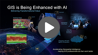
By combining artificial intelligence (AI) with geographic information systems (GIS) - an approach known as GeoAI - organizations gain the ability to analyze patterns across space and time. This allows them to understand where, when, and how risks may emerge and move beyond reacting to disruption toward anticipating, preventing, or significantly mitigating its impact.
This article explores how AI, particularly GeoAI, is reshaping risk management, why its potential is often overlooked, and how leading organizations are using predictive systems to protect their most critical assets.
Ready to elevate your organization? Connect with our GeoAI experts.
The risk reality: AI isn’t just about efficiency anymore
Most organizations begin their AI journey with efficiency in mind: streamlining processes, reducing costs, and accelerating insights. These benefits matter, but they represent only a fraction of AI’s strategic value.
The real value lies in foresight.
AI can help leaders understand how risk evolves, where it will emerge, and how severe the impact could be. Yet many organizations overlook this because of two common biases:
- Generative AI dominates the conversation
Chatbots and text-based tools get the headlines. Meanwhile, the AI models that matter most for risk, machine learning and deep learning, quietly deliver predictive insights that drive operational, environmental, and financial resilience. - Risk is inherently spatial
Many risks, from natural hazards to asset vulnerabilities and supply chain disruptions, are tied to location. Without understanding where a risk may strike, estimating what it will cost becomes little more than guesswork.
This is precisely where GeoAI becomes essential.
GeoAI: Where location meets predictive intelligence
GeoAI integrates AI techniques, GIS data, and spatial analysis. Instead of treating data as isolated rows in a spreadsheet, GeoAI layers information across maps, time, and physical relationships in the real world.
This matters because nearly all critical business risks are spatial:
- Extreme weather affects specific facilities
- Wildfires follow geographic patterns
- Supply chain disruption occurs along physical routes
-
Infrastructure vulnerabilities vary by transportation and environment
Talk with our specialists and see what GeoAI can do for your organization.
Machine learning and deep learning deliver measurable business value by uncovering patterns, quantifying risks, and generating reliable forecasts.
Imagery and remote sensing, on the other hand, supply continuous, high-resolution, and geographically expansive data streams. When integrated with AI, this spatial data is transformed into predictive intelligence enabling weather forecasting, early detection of crop stress, infrastructure risk identification, and other forward-looking insights that strengthen operational resilience and strategic planning.
Turning insight into action
As risks grow more complex and interconnected, relying on historical data and static models is no longer enough.
Organizations that embed location intelligence into their AI strategies gain a decisive advantage: the ability to anticipate risk before it materializes, act with confidence, and prioritize the right interventions at the right locations.
Strengthen your risk management strategy with GeoAI
When everyone operates from the same spatial view of risk, decisions become faster, clearer, and more aligned. GeoAI turns complex, rapidly changing conditions into precise, actionable intelligence.
Learn how ArcGIS brings AI, imagery, and location intelligence together as a unified GeoAI platform — helping organizations move from reacting to risk to staying ahead of it.
Discover how GeoAI can transform your organization. Book a consultation today.
PLN success story: Smarter vegetation management for electricity utilities
As a GeoAI platform, Esri’s ArcGIS enables organizations to assess exposure and impact with a level of precision that traditional dashboards simply cannot provide.
A compelling example comes from the electricity utility sector, where traditional forecasting often lacks the granularity required for effective risk mitigation.
PT PLN (Persero), Indonesia’s primary electricity provider, faces ongoing challenges in ensuring reliable and safe power distribution across a vast and varied environments. One major contributor to outages and inefficiencies is vegetation encroachment on power lines.
Reactive vegetation management is costly, time-consuming, and increasingly inadequate for a growing and dynamic distribution network. By leveraging AI and location intelligence, PLN introduced Smart Distribution Vegetation Management (SmartDVM) — a GeoAI-powered solution built on the ArcGIS platform.
SmartDVM transforms vegetation management from a reactive process into a proactive, data-driven strategy. It enables PLN to:
- Predict risk areas
- Prioritize interventions
- Improve network reliability
- Optimize operational costs
As a result, SmartDVM helps PLN to achieve up to 85% detection accuracy and delivers analysis five times faster than traditional manual methods.
Watch this video and discover how you can leverage ArcGIS as a GeoAI platform — just like PLN: