Perusahaan Listrik Negara (PLN) is Indonesia's state-owned enterprise responsible for most of the electricity supply across the archipelago.
PLN oversees nearly 70,000 lines of transmission and over one million km of distribution, serving more than 100 million customers. With over 17,000 islands comprising Indonesia, PLN's task of ensuring reliable, efficient, and sustainable electricity distribution poses unique challenges.
PLN's commitment to innovation has led the utility to leverage advanced solutions such as geographic information system (GIS) technology to meet some of these specific challenges.
Challenge
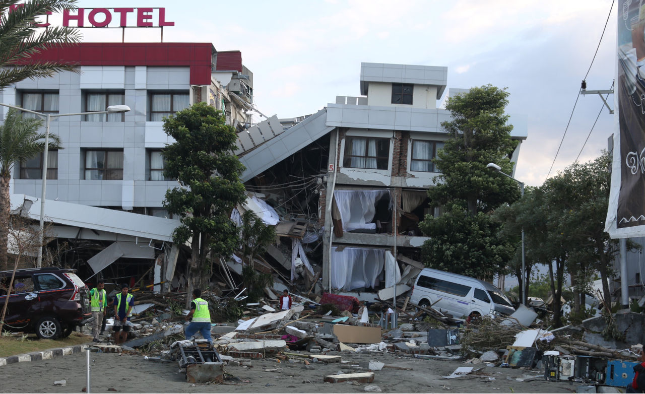
The earthquake and ground liquefaction natural disasters in Palu in 2018 greatly impacted infrastructure, including the destruction of electrical assets. What became clear to PLN was that restoration of power to its impacted customers simply took too long. Some customers were without power for up to a month or more. The problem was that PLN lacked insight into the vulnerability of their assets regarding potential hazards that could occur in any region. Indonesia is located in what some call the "Ring of Fire," where volcanic and seismic activity are common. PLN has experienced many disasters over the last five years, such as floods, earthquakes, tsunamis, volcanic eruptions, and landslides. Climate change will likely increase the frequency and duration of some of these natural events.
In addition to these major challenges, like most utilities today, PLN is also facing a significant energy transition consisting of the "Three Ds":
- Decarbonization: the addition of renewable resources, EV charging infrastructure, and expanded electrification
- Decentralization: the implementation of a smart grid
- Digitization: the aggressive digitization of assets, with GIS playing a major role
Solution
PLN used Esri products, including ArcGIS Pro, ArcGIS Online, and ArcGIS Dashboards, to digitize data and conduct spatial analysis and smart mapping. These tools have empowered PLN to ensure the accurate repair or replacement of assets at the right time in the right locations.
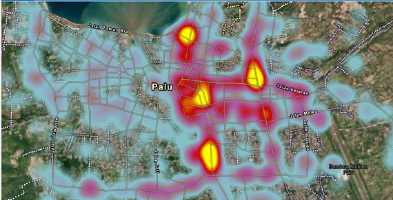
Digitizing the electrical assets in GIS allows PLN to spatially locate their equipment near where natural disasters are most likely to occur. In addition, gaining better insight into asset condition allows PLN to gain insight by mapping areas of high external risk with assets needing maintenance or repair. Adding condition information to the assets allows PLN to prioritize hardening efforts that provide optimal resilience when faced with inevitable catastrophes.
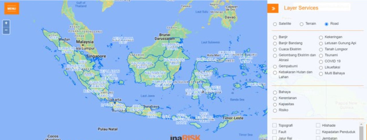
Using ArcGIS Online, PLN developed a risk assessment portal as a data service that depicts the coverage of disaster threat areas, including affected populations' potential physical and economic losses. The portal, dubbed InaRISK, also displays the potential for environmental damage. It is integrated with locations of risk reduction activities as a monitoring tool for reducing the disaster risk. The key is overlaying government risk assessment data from the BNPB (Indonesia's National Agency for Disaster Countermeasure) with asset condition data.
Vital to the solution is the recognition that PLN needs to address both reliability and resilience. The system must be able to deliver electricity to consumers without interruption while also being able to withstand and recover from disruptions.
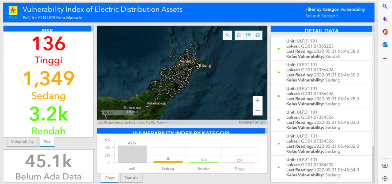
PLN is thus focusing on vulnerability to improve both these areas and calculates system vulnerability using the equation VI = HI x ∑RI, where:
VI: Vulnerability Index: Vulnerability index or asset vulnerability
HI: Health Index: Asset health index from internal conditions determined by digital inspection of the assets
RI: The sum of all possible external risks (floods, earthquakes, liquefaction)
The solution involves mapping vulnerabilities, which provides insight into what to work on and where to optimize reliability and resilience.
Results
The program illustrates the value of using GIS in combination with readily available disaster data from government sources. Dashboards provide management with a complete view of the analysis and a means of monitoring the network hardening process. It also gives clear insight into the state of the electric network concerning natural disasters.
Partner
Esri Indonesia provided data modeling, implementation, and configuration support at all project phases.
Benefits
PLN can determine the level of risk to assets from disasters and prepare a budget accordingly. Measuring the level of vulnerability is useful for determining priorities in managing distribution networks and makes it easier for engineers to plan asset investments. This process contributes to the digital transformation program for the energy transition.
Measuring and mapping vulnerability in the network determines the level of disruption or system failure caused by internal and external factors. GIS provides insight through analysis results, maps, and dashboards. With this insight, PLN can take the necessary preventive or corrective steps to reduce the risk of disruption or system failure.
Additionally, during an event, PLN can continuously monitor the level of alertness of conditions.
Now customers can experience fewer outages, shorter restoration times, and better visibility of situations as they unfold. By targeting the optimal hardening efforts, PLN lowers its capital and operating costs by knowing that the company is working on the most impactful aspects of the network.
Next steps
Plans are underway for a complete rollout of the system. Digitization of the entire network into GIS is continuing. PLN is investigating how to advance its integration of GIS technology by utilizing imagery and advanced spatial analysis, implementing ArcGIS Image Server, and integrating GIS with other corporate IT systems.
Soffin Hadi, vice president of transmission and distribution from 2018 to 2021 and general manager at PLN, emphasized the impact of the utility's digital transformation. "This project shifted how we thought about our ability to be proactive in planning and response to disaster management."
"GIS gave PLN the means to create Aha moments by integrating government disaster data with network asset information, It became a game changer."
Very Fernando, PLN manager