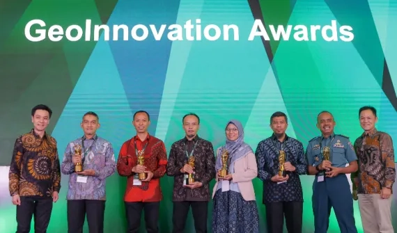
The inaugural 2023 'Innovation under the microscope journalism competition' will run from 13 September - 30 November. We invite journalists from across Indonesia to take part and explore the dynamic world of Geographic Information Systems (GIS) technology and how it's shaping tomorrow!
Get involved
- Topics for consideration
Develop an article between 500 to 750 words, using one of the topics/themes below:
GIS in action articles:
Palm oil plantation
- Write an article focused on how GIS technology supports the global palm oil industry’s recent efforts to modernize its operations. Look at a topic from a climate challenge, ESG (Environmental, Social and Governance) and/or economic perspective.
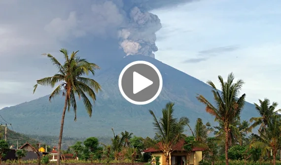
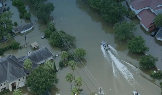
Better tech saves lives
- Explore the solutions GIS technology underpins in emergency and disaster response. Write an article focusing on disaster preparedness, response, mitigation and/or risk assessment and the crucial role GIS technology plays.
Thought leadership articles:
AEC (Architecture, Engineering and Construction):
- The AEC sector utilizes GeoBIM software to communicate, collaborate and establish new workflows across verticals. Create a thought leadership piece on the benefits of how GeoBIM software is being used to plan and build the most advanced city in the world – IKN. A thought leadership piece should convey the interviewee’s expertise on the topic with a conversational, engaging tone.
ESG (Environmental, Social and Governance):
-
Choose any sector globally where GIS technology is supporting an ESG goal. Present how organizations locally could apply the same thinking and practices to bring Indonesian enterprises into line with global best practices. For more information, read about efforts in the ESG space by Australia's mining industry, from a US perspective and Nespresso's initiative. A thought leadership piece should convey the interviewee’s expertise on the topic with a conversational, engaging tone.
Have a different article topic in mind? We’d love to hear it….
If your investigation into the use of GIS technology has generated a different idea for an article, we encourage you to pursue this angle. All article topics will be accepted.
- Important information you need to know: Guidelines
All journalists and freelancers are encouraged to take part in the competition. To have your story considered in the competition, simply follow these guidelines.
- No industry can be reported on with negativity - the story must be progressive and drive industries forward;
-
Articles must include one or more of these keywords:
GIS, geospatial technology, teknologi geospasial, location analytics, smart mapping, SIG, IKN, Esri, ArcGIS, Pemetaan, Satu Peta, One Map Policy, Kebijakan satu peta, Esri Indonesia, Sistem Informasi Geografis, Kecerdasan lokasi, Analisa lokasi, Lokasi analitik;
- Participants may obtain additional data from other sources such as interviews, journals, books, or other valid and accountable references;
- Journalist participants must work for or have stories published in media outlets that are registered with the press council and are legal entities;
- The written work must be original and not an adaptation or plagiarized;
- The article must be published in the participant's media;
- Participants may write more than one news article.
- To submit your article into the competition, simply email the article URL to Pranowo Tri Adhianto nowo@imgnpr.id. Remember to include your contact details. We will also be monitoring media for published stories.
- Prize money
- First place - Rp.5,000,000
- Second place - Rp.3.000.000
- Third place - Rp1.500.000
- Next best 10 articles - Rp300.000 (e-wallet money).
- Judging
A panel of three judges will grade the top 13 stories against these criteria points:
- Intriguing and impactful title;
- Topic appropriateness and depth;
- Factual reporting and evidence;
- Context and background information;
- Presentation of innovative and creative information;
- Writing ability
- Interviews & Quotes
There are a number of potential interview candidates listed below who can assist journalists with interviews. We encourage you to contact these representatives from Esri Indonesia and other stakeholders to ask questions and learn more about the many layers of GIS technology.
Solution Strategist Team Lead (National Government) - Faris Sofi - fsofi@esriindonesia.co.id
Esri Indonesia Solution Strategist Manager - Khairul Amri - kamri@esriindonesia.co.id
Frequently asked questions
- What is Geographic Information System technology?
Maps have been the catalyst to some of the greatest discoveries in history. They have always had the power to guide and inspire, but the reach of maps has only broadened in modern times. Smart mapping technology has added a new dimension to the practice of analyzing information.
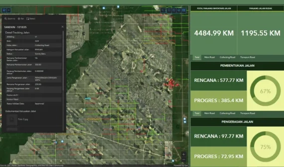
GIS technology makes the study of spatial relationships within data possible. The technology literally maps the geographic elements contained within an organization’s data, exposing patterns and connections that may otherwise be hidden in a maze of numeric tables. Commercial, government and community groups all benefit from taking a geographic view of their enterprise, across areas including:
- Planning and analysis
- Field force management
- Asset and data management
- Situational awareness
- Citizen and customer engagement
- How is GIS used?
Hundreds of thousands of organizations in virtually every field are using GIS to make maps that communicate, perform analysis, share information, and solve complex problems around the world. This is changing the way the world works.
- How does GIS work?
GIS technology applies geographic science with tools for understanding and collaboration. It helps people reach a common goal: to gain actionable intelligence from all types of data.
- Who is Esri Indonesia?
To learn more about us, click here.
- What is ArcGIS?
ArcGIS integrates and manages all types of data. The software is a mapping, analysis, visualization and data management system. It offers unique capabilities and flexible licensing for applying location-based analytics to business practices. The platform provides greater insights using contextual tools to visualize and analyze data. The software collaborates and shares via maps, apps, dashboards and reports.
ArcGIS is typically relied on for:
- Mapping and visualization
- Data Management
- Field Mobility
- Analytics
- Design and Planning
- Decision Support
- Constituent Engagement
- Sharing and Collaboration.
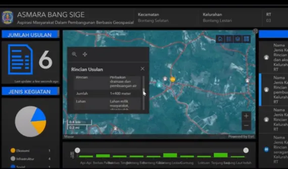
- What role does GIS play in government?
The One Map, One Data policy provides government bodies across Indonesia with access to GIS technology. The goal is to increase data availability to make it easy to find, access, and use online. This in turn will make geospatial data more accessible to the public, increasing its benefits. The vision is for geospatial data to be more easily acquired and created throughout the island nation. This will support regional development planning and will help manage resources, protect the environment and mitigate natural hazards.