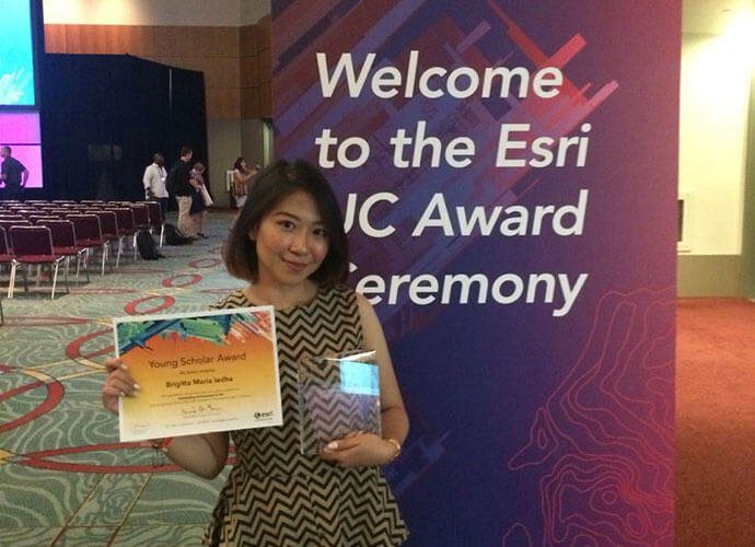
Winning the 2018 Indonesia Esri Young Scholar Award, Brigitta Maria Ledha, student from Gajah Mada University acquired an opportunity to showcase her tourism app, LUNGO! Jogja at Esri User Conference in San Diego, US.
A Universitas Gadjah Mada student’s passion to improve the tourism experience in Jogjakarta has landed her the trip of a lifetime to attend the world’s largest spatial conference in San Diego, California.
Geodetic engineering student Brigitta Maria Ledha from the Universitas Gadjah Mada has won the 2018 Esri Young Scholar Award Competition, for creating an intelligent online tour advisor app called LUNGO! Jogja. The app, given user interactions will identify patterns in travel preference and recommend customised advice for the traveler.
The nation-wide competition celebrates excellence in geospatial study and, more specifically, the creative use of GIS technology to solve real-world challenges in the community.
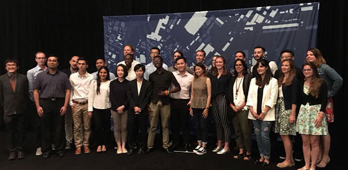
Brigitta beat a quality field of entries to book her place at the Esri User Conference in the United States in next month, where she will showcase her app to 15,000 visitors from 150 countries.
According to Brigitta, the word “lungo” in Java means “go”. However, in this app, lungo is the abbreviation for “Let Us kNow you Go”
“LUNGO! Jogja, is a web app that aims to provide location-relevant travel recommendations in Jogjakarta. Using the app, tourists can get helpful travel tips based on their personal travel preferences and budget,” she said.
“I am currently enrolled at a university in Jogjakarta. Whenever my family would come to visit me, they would always ask me to be their tour guide in the city. I will always provide a helpful reference of places they should visit, but somehow the reaction I get from each person is always different. Not every place is suitable for everyone. That’s why I thought there’s a need to create an app that can help people better plan their visit based on their personal preferences.”
“I am very happy to have been chosen to receive this award. I really enjoyed developing the app and I look forward to more exciting innovations I can create with GIS technology. I would like to thank Esri Indonesia for this opportunity to share my work to a wider audience both in Indonesia and the United States.” Brigitta said.
The award’s judging process saw students present their projects to an esteemed panel which included industry experts such as: Yudi Syahnur, Sr Data Management Analyst of Saka Energi Indonesia; Nazib Faizal, ST, MSc – Sub Directorate Head for Data Analysis and System Development; Directorate of Road Network Development - Ministry of Public Works and Public Housing; Dr. Syartinilia, SP, MSi, Lecturer at Institut Pertanian Bogor and, Esri Indonesia Chief Executive Officer.
Esri Indonesia Chief Executive Officer said the quality of the entries for this year’s competition exemplified the growing talent pool of young smart mapping talents in Indonesia.
“The demand for geospatial disciplines such as Big Data Analytics, Field Mobility, and 3D Analysis within Indonesia’s universities is growing – and thousands of students now regularly draw on spatial technologies to solve real-world issues,” he said.
“Brigitta’s winning entry demonstrated the real difference modern GIS technology can deliver when used creatively to solve complex community and business problems.”
Yudi Syahnur, Sr Data Management Analyst of Saka Energi Indonesia, said: “Brigitta’s winning project demonstrates a deep philosophical view of the role modern geography plays in developing relevant and consumer-focused applications. By drawing on the universal element of location, GIS technology provides a strong foundation for students to solve problems – from identifying issues, to finding the solution. Brigitta has also formed her solution on the unique topic of tourism, which is an important cultural focus for Indonesia.”
Nazib Faizal, ST, MSc – Sub Directorate Head for Data Analysis and System Development Directorate of Road Network Development – Ministry of Public Works and Public Housing, said Brigitta’s project answered a unique set of important questions currently facing the eco-tourism sector.
“The project highlighted the fact that by using GIS technology to enhance the user’s experience, we will be able to unlock new tourism and investment opportunities,” he said.