*JAKARTA – Indonesia 4.0 or the so-called 4th generation of the world’s industrial revolution is characterised by the existence of a software-enabled intelligent system and automation in daily life.
Almost all industrial sectors in Indonesia are currently carrying out digital transformation, to shift the workflow process from manual (paper-based) to digital and automation. Data-based solutions, location and artificial intelligence (AI), often referred to as geospatial artificial intelligence (GeoAI), is an approach to solving problems using geographic information systems combined with AI, machine learning and deep learning.
In today's era of digital transformation, the use of geospatial technology, big data, and AI has sparked many advances policy determination and decision-making.
Hosted by Esri Indonesia, a leading provider of software and solutions based geographic information systems, the GeoAI Summit 2022 in Jakarta provided a forum for over 350 in-person and online delegates to meet and discuss implementing GeoAI technology within their respective domains.
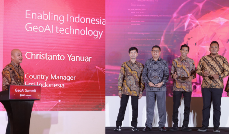
According to Esri Indonesia Country Manager, Christanto Yanuar, many companies offer AI solutions, but combining location intelligence (data, geographic information) with AI is a plus offered by Esri Indonesia.
"The GeoAI Summit demonstrated the use of GeoAI in various industries,” said Christanto.
”The ability to detect objects, find patterns and make predictions, that can be viewed and accessed through dashboards anytime, anywhere, is extremely valuable. Together with BNPB, Esri Indonesia has built a disaster management dashboard to identify the coordinates of the worst affected areas and determine the priority scale of assistance, such as for the recent earthquake in Cianjur."
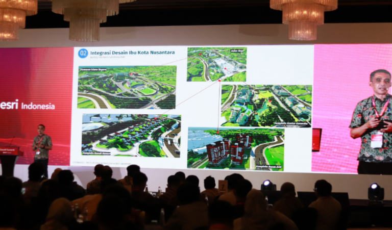
Keynote speaker Dr. Ir. Ade Komara, Head of the Center for Rupabumi and Toponym Mapping from the Geospatial Information Agency, emphasised the importance of accelerating the provision of large-scale based maps as a key part of the main infrastructure used when institutions or organisations make thematic maps.
In his presentation, Ade also discussed that to accelerate the provision of a detailed scale-based map, it is necessary to look for economical, fast, and appropriate technologies and methods that meet its quality requirements.
"GeoAI is a technology that meets these three prerequisites. Based on our study, automation using AI can save more than 79% of data processing time compared to manual processing," said Ade.
As for the Ministry of PUPR, Nazib Faizal, the Head of Pusdatin said, "GeoAI is used to accelerate decision making and as a consideration in making policies, using quite a lot of parameters and data so that the public get maximum outcomes."
Nazib gave an example of one of the implementations of GeoAI by modelling traffic trends, including vehicle license plate detection for Multi-Lane Free Flow and disaster trend analysis.
"GeoAI is the future that we must immediately implement in Government policy and decision making," he added.
This was reiterated by Prayogi Setyo Pratomo, Head of the Traffic and Security Department, Astra Tol Cipali in the GeoAI technology presentation session.
"In an effort to improve toll road traffic & safety, deployment of GeoAI technology and deep learning frameworks can help monitor roads to assist in identifying obstacles and provide real time information to make faster decision making. For example, emergency response units can be deployed immediately after an accident or disruption has occurred. This is not only useful for traffic management, but also has the potential to save lives,” said Prayogi.
Another guest speaker, Tri Haryo Sagoro, Head of GIS at Wilmar International Plantation, shared stories from Wilmar's oil palm plantation.
"With GeoAI technology, plant health can be monitored and mitigated. In addition, if there is a disease infection, oil palm trees can be treated immediately to minimize the spread which will cause more losses," he said.
Esri Indonesia’s Country Manager, Christanto Yanuar, closed the Summit by reminding audiences of the diverse uses of GeoAI technology in areas such as marketing planning, site selection, price optimization, product selection, and workflow automation to provide fast and precise service and decision delivery.