
GIS provides powerful tools for spatial planning, from site suitability analysis and 3D urban planning, to land classification with machine learning.
ArcGIS solutions for spatial planning
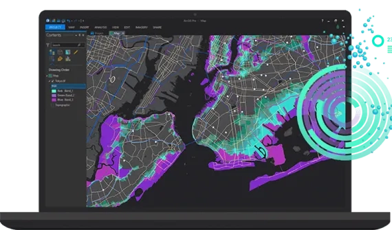
Site Suitability Analysis
Use weighted suitability analysis to support your spatial planning.
- Ready-to-use suitability analysis tools for urban and regional planners
- Access valuable open raster data including bioclimates, elevation, land cover, population, slope, temperature difference, and more
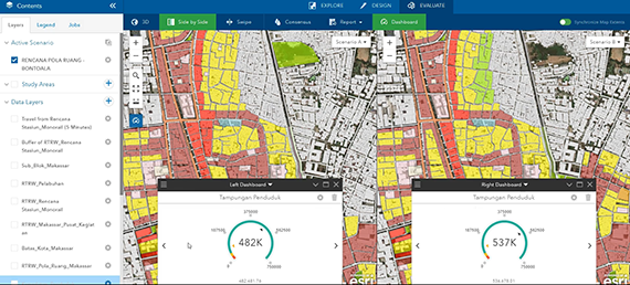
- Explore, design, evaluate, and collaborate on your spatial plan through
multiple scenarios
Products
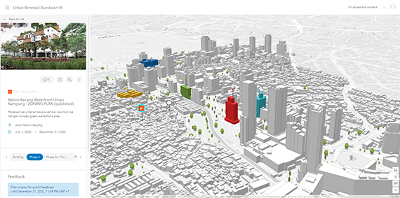
3D Urban Development and Zoning Simulation
Access immersive 3D visualisations of developments and create simulations based on local zoning regulations.
- Build and evaluate plans with simulation models that include local zoning regulations, space-use types and building types
- Create 3D visualisations of urban plans and projects to inform all stakeholders – including the public
- Communicate trends and planning performance through indicators such as population growth, new job creation, water usage, waste generation and more
Product mix:
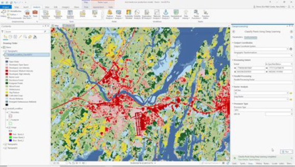
Automatic Land Coverage Classification from Imagery Data
Use deep learning models to automate feature extraction processes and simplify the way you acquire and share land coverage data.
- Automate the creation of land coverage data with feature extraction, empowered by Esri’s deep learning framework
- Easily define and tune your own training data with an intuitive user interface
- Share your imagery data and collaborate across your organization
Products
- ArcGIS Pro
- ArcGIS Image Analyst
- ArcGIS Server Enterprise (Advanced)
- ArcGIS Image extension for Server
- ArcGIS Notebooks extension for Server