Esri Indonesia, the nation’s leading geospatial solutions provider, has launched a Onemap.id — a Geographic Information System (GIS)-based portal supporting local government digital transformation to drive informed policy-making, improve service delivery, and increase public satisfaction.
The portal features thematic solutions such as epidemiological surveillance, tax and revenue management, crime monitoring, environment and waste management, tourism, disaster management, Infrastructure management, social assistance, community engagement, and more.
The easy-to-deploy solutions readily integrate with existing systems without the need for a single line of code, according to Esri Indonesia's Chief Industry Solution Officer, Cahyo Nugroho.
“The COVID-19 pandemic has fast-tracked digital transformation across several organisations, and the best way to deliver better public services is to leverage geospatial data to make smarter policy decisions and drive sustainable development,” Mr Nugroho said.
“By visualising public infrastructure — such as reservoirs, bridges, and dams —decision-makers can use GIS technology to make the most of public funds and infrastructure investments. The integration of advanced geospatial-based Artificial Intelligence technology — Geo-AI — can also be used to analyze infrastructure object, such as road damage.
“Using interactive maps and monitoring through a single dashboard helps decision makers plan and extend the useful life of public infrastructure assets and ensures we make the most out of taxpayers’ money. It also means younger generations can continue to benefit from this infrastructure in the future,” he said.
“This is just one of the many ways GIS technology is helping cities worldwide become smarter, and OneMap.id can help pave the way for the rise of smart cities across the country,” he said.
As of October 2021, 15 cities are leveraging OneMap.id solutions, including Kabupaten Gresik, Pasuruan, Sampang, Kota Banjarbaru, Kabupated Kutai Kartanegara, Wonogiri, Puncak Jaya, Provinsi Maluku, Sulawesi Selatan, Kota Mojokerto, Bontang, Provinsi Kawa Timur, Kabupaten Hamahera Utara, and Kabupaten Halmahera Timur.
Bontang City Government
Bontang utilizes GIS technology to support its urban planning processes and improve service delivery.
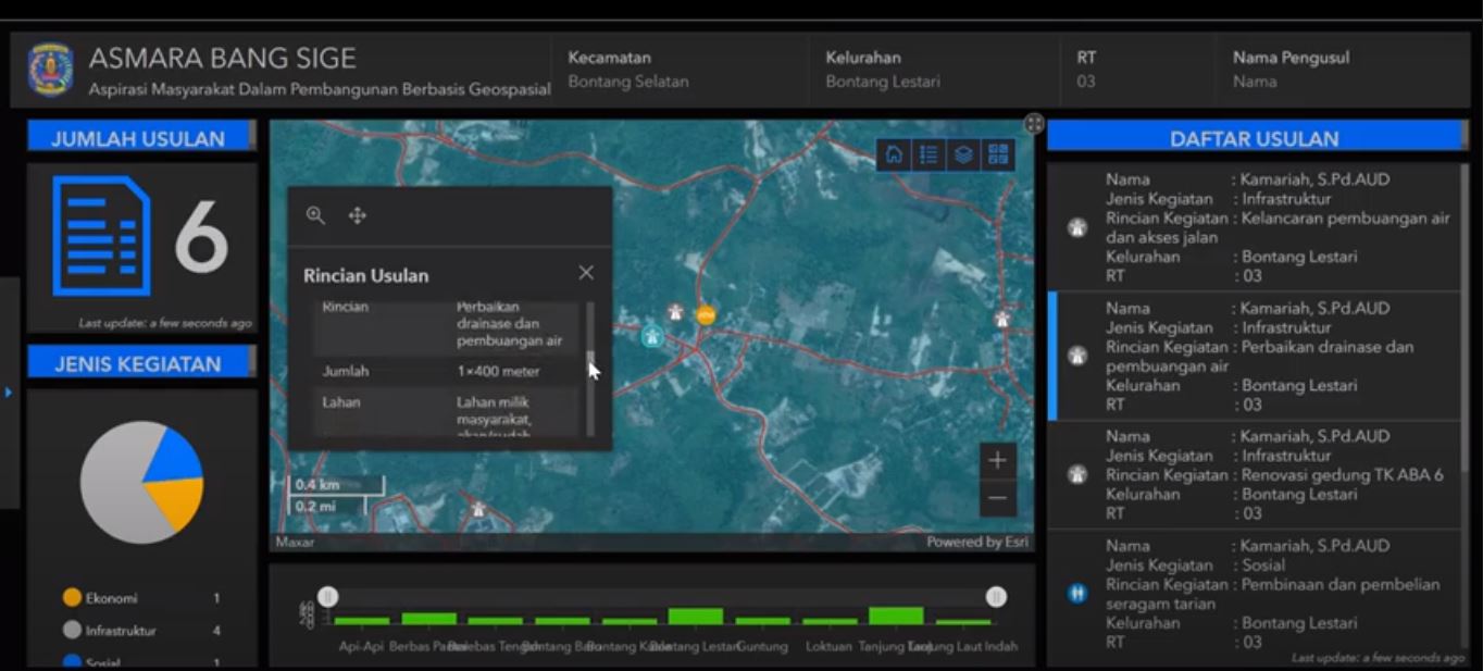
The Asmara Bang Sige (Community Aspirations in Geospatial-Based Development) online forum is a community feedback tool ensuring the city’s sustainable and inclusive growth.
Residents can voice their opinion on urban development plans before they begin, allowing changes to be made with minimal cost and impact on citizens.
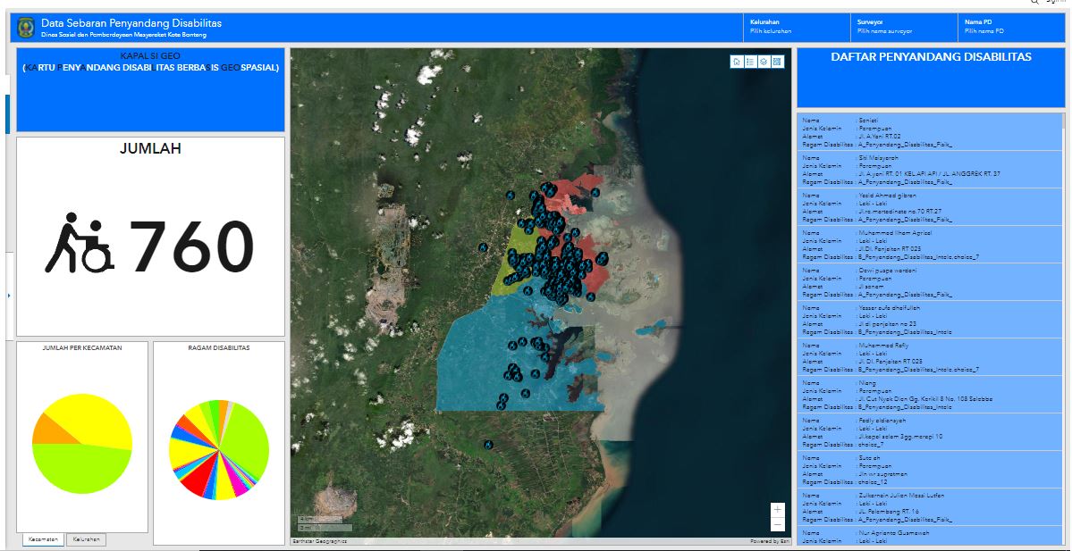
Kapal Si GEO (Geospatial-Based Disability Card) is another application underpinned by geospatial technology connecting residents with information on disability services and programs.
During the pandemic, city officials leveraged community feedback from Bontang’s 499 neighborhoods to inform strategic response policies and decisions.
“Processing community feedback manually makes it almost impossible to prioritise and respond quickly given the sheer number of requests we receive every day.
“By leveraging GIS technology, we are able to monitor requests in real-time and provide the best service for Bontang residents, while cutting costs and increasing productivity,” said Amiruddin, Head of Bapelitbang Bontang City.
“As GIS adoption increases across the city’s different departments, there will be a thematic, holistic, integrated, and spatial approach to Bontang’s sustainable development,” concluded Amiruddin.
Onemap.id provides examples of how geospatial technology is applied across various local government departments and workflows, showcasing a number of solution modules including dashboards, web applications, and other web-based and mobile applications.
For more information about Onemap.id please visit https://esriindonesia.co.id/onemapid or get in touch with our team.