You are here News and events News News Search news Search by year All20252024202320222021202020192018201720162015201420132012 Tags - Any -3DABSEventsLand AdministrationAECAgileAgribusinessAgricultureWaterfallLocation-based analyticsBig Data AnalyticsGeospatial AnalyticsUrban analyticsPredictive analysisReal-time analyticsTransport analyticsAnalyticsData analyticsAppsMobile applicationsAppStudioArcGISArcGIS 10.5ArcGIS 10.6ArcGIS EnterpriseArcGIS Enterprise 11.5ArcGIS Enterprise 12.0ArcGIS Enterprise upgradeArcGIS HubArcGIS IndoorsArcGIS OnlineArcGIS ProArtificial intelligenceAsset managementInsuranceInsurance and BankingAugmented realityAustralian Bureau of StatisticsAutodeskBankingBIBig DataBIMBusinessBorder PatrolBusiness IntelligenceCadastreCalifornia CoastlineCitizen engagementClean energyCloudCloud computingCloud GISCollectorCommercialCommercial propertyCommunityContentCoronavirusCouncilCOVID-19Crisis CrowdsourcingDataRaster dataData visualisationDeep learningDefence and intelligenceDekhoDesignSpeculative designDigital constructionDigital engineeringDigital transformationDigital transformationDigital twinDisruptive appsDronesResourcesEducationGreen economyeLearningElectionElectorateElectricElectricityEmergency managementEmergency responseEmergency servicesEnergyRenewable energyEnergy, oil, gas and renewablesEngineeringEnterprise GISENVIEnvironmental managementEsriEsri AustraliaEsri Petroleum ConferenceEsri UCEsri Young Scholar AwardEsri Young Scholars AwardFederal governmentFinancial institutionsFinancial servicesFood securityForestryGasGDA2020GDA94Geo hubGeoAIGeoAnalyticsGeoBIMGeographic datumGeographic Information SystemsGeospatialGeothermalSolar eclipseGISGIS for schoolsGIS for urban and regional planningGIS in miningGIS in national government GIS in oil and gasGIS managerGIS server softwareGIS technologyGIS untuk perencanaan kota dan wilayahGIS web servicesGovernmentGovernmentMount AgungHealthHealth and human servicesHomeland SecurityIcon WaterIDLImageryImpact AwardsIndoor navigationPetroleumTransport and InfrastructureInnovationInsights for ArcGISLocation intelligenceOperational intelligenceInteractive mapsInternet of ThingsInternshipInteroperabilityIoTJack DangermondUtility networkJavaScriptNational SecurityPublic safetyPartnershipKerajaan Negeri SembilanOperational awarenessOH&SSmart communitiesSafe communitiesLand managementLaura DangermondLaw enforcementLive dataLive sensorsLocal governmentLogisticsMachine learningSupply chain managementMapping and chartingMapsMaritimeResilient communitiesMediaMicrosoft AzureMiningMining explorationOilOil & gasMobileMobile GISNational developmentNot for profitOpen dataOpen platformOz MineralsOzriUnited NationsPortsTrainingSustainable developmentState governmentSite ScanSAR ImagerySatellite imagerySAG AwardsRemote sensingPlanningUrban planningPERHAPIUnmanned Aerial VehiclesPETRONASProductsPublic sectorQueensland GlobeRetailUser researchROISaaSSabah Lands and Surveys DepartmentSAPSARscapeSensorsSmart transportSmart citiesSmarterWXSpatial data infrastructure solutionsStartupsStory mapsWaterSurvey123TelcoTelecommunicationsTransformationTransportTransportationTSFUIUnearthed ChallengeUser experienceUser interfaceUtilitiesUXUXGVirtual realityWeb GISWHO Indonesian companies receive Special Achievement in GIS (SAG) Awards For their innovations in geospatial technology, Jababeka and Sinar Mas Forestry were honoured at this year's virtual Esri UC. Learn more Esri named a leader in location intelligence platforms report The Forrester Wave highlights the company's long-term commitment to the development of a shared global geospatial infrastructure. Learn more Esri partners with WHO as part of COVID-19 response Integrated geospatial data and analytics is important to a dynamic response to the rapidly changing situation related to COVID-19. Learn more News Using location intelligence to track Indonesia's COVID-19 crisis in real-time Esri Indonesia's ESSC launches a COVID-19 Geoportal to help local authorities and communities take precautionary measures against the virus. Learn more News ESSC's GIS-powered dashboard helps tackle the city's floods The Jakarta Flood Map Portal successfully accelerated decision-making and response to the flood disaster. Learn more News Salesforce selects Esri as key geospatial partner Salesforce selects Esri, the global leader in mapping and location intelligence, as its key geospatial partner for Salesforce Maps and facilitating the integration of Esri's ArcGIS Living Atlas. Learn more News Contributing to Education, Esri Indonesia Wins UI Award 2019 Awarding the UI Award for Education Sectors by University of Indonesia Rector, Prof. Dr. Ir. Muhammad Anis, M. Met. and received by CEO Esri Indonesia. Learn more News Emergency response to forest fires Mapping dashboards are helping authorities visualise data on potential fire hotspots and air quality across Sumatra and Kalimantan. Learn more Esri named leader in location intelligence Learn more Spatial technology saves Pertamina Hulu Mahakam millions Learn more Esri supports SAP HANA platform Learn more Learn more Esri earns top ranking in latest Forrester report Learn more Learn more Learn more Global smart mapping competition to award tech-savvy students Learn more Learn more Learn more Learn more Learn more Load More
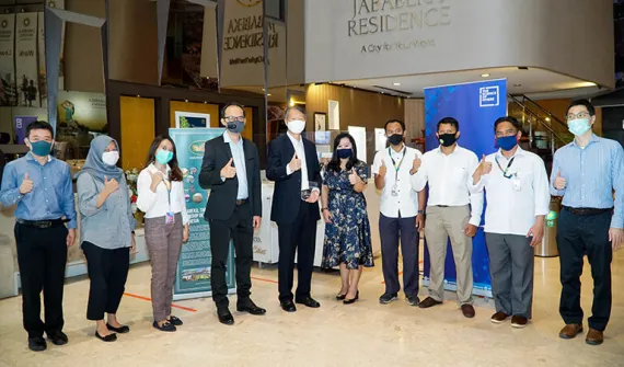
Indonesian companies receive Special Achievement in GIS (SAG) Awards For their innovations in geospatial technology, Jababeka and Sinar Mas Forestry were honoured at this year's virtual Esri UC. Learn more
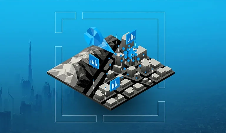
Esri named a leader in location intelligence platforms report The Forrester Wave highlights the company's long-term commitment to the development of a shared global geospatial infrastructure. Learn more
Esri partners with WHO as part of COVID-19 response Integrated geospatial data and analytics is important to a dynamic response to the rapidly changing situation related to COVID-19. Learn more
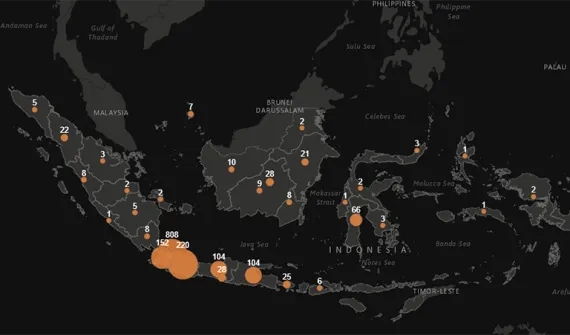
News Using location intelligence to track Indonesia's COVID-19 crisis in real-time Esri Indonesia's ESSC launches a COVID-19 Geoportal to help local authorities and communities take precautionary measures against the virus. Learn more
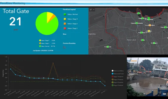
News ESSC's GIS-powered dashboard helps tackle the city's floods The Jakarta Flood Map Portal successfully accelerated decision-making and response to the flood disaster. Learn more
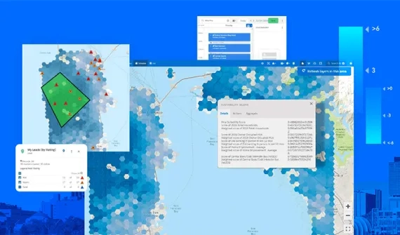
News Salesforce selects Esri as key geospatial partner Salesforce selects Esri, the global leader in mapping and location intelligence, as its key geospatial partner for Salesforce Maps and facilitating the integration of Esri's ArcGIS Living Atlas. Learn more
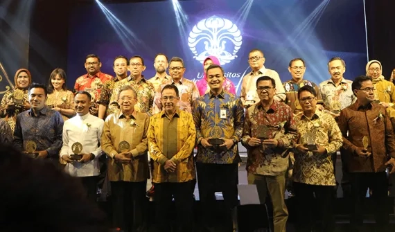
News Contributing to Education, Esri Indonesia Wins UI Award 2019 Awarding the UI Award for Education Sectors by University of Indonesia Rector, Prof. Dr. Ir. Muhammad Anis, M. Met. and received by CEO Esri Indonesia. Learn more
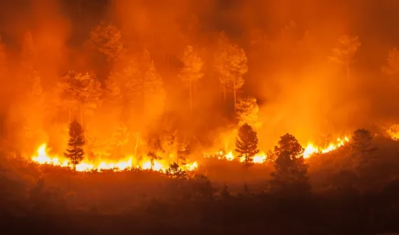
News Emergency response to forest fires Mapping dashboards are helping authorities visualise data on potential fire hotspots and air quality across Sumatra and Kalimantan. Learn more