You're viewing the English translation
Esri Indonesia | Home

Main navigation

  • Industries
    • Commercial
      • Architecture, engineering and construction
      • Banking and financial services
      • Electricity
      • Forestry
      • Manufacturing
      • Market development
      • Media
      • Mining
      • Oil & gas
      • Plantation
      • Property and real estate
      • Retail
      • Telecommunications
      • Transportation and logistics
      • Water
    • Government
      • Solutions for government
      • Cities and municipalities
      • Defence and intelligence
      • Emergency and disaster response
      • Maritime and hydrography
      • Infrastructure and public works
      • Land administration
      • National government
      • Provincial government
      • Spatial data infrastructure
    • Community
      • GIS for schools
      • Fellowship Program
      • Fellowship Program Hall of Fame
      • Esri Young Scholar Award
      • Non-profit
  • Products
    • Capabilities
      • Digital twins
      • Field operations
      • Imagery and remote sensing
      • Real-time visualisation and analytics
      • Spatial analytics
    • About ArcGIS
      • ArcGIS user types
      • ArcGIS product licensing
      • ArcGIS Online
      • ArcGIS Pro
      • Migrating to ArcGIS Pro
      • ArcGIS Enterprise
      • ArcGIS Location Platform
      • ArcGIS Developer
      • ArcGIS for Personal Use
      • ArcGIS Online free trial
      • See other Esri products
    • Applications
      • Apps for the office
      • Field operations
      • Apps for the community
      • App Builders
      • LivingLab
      • NV5 Geospatial
    • Data
      • GIS data
      • Open Data
      • Data Interoperability
      • Open Standards
      • Esri’s Open Vision
  • Services and support
    • Services
      • ArcGIS maintenance program
      • Consulting services
      • Project services and application development
      • Managed services
    • Technical support
      • Esri Support App
      • Support resources
      • Support programs
      • Support request
    • Training
      • Training calendar
      • Training courses
      • GeoEnablement Portal
      • Submit a training enquiry
  • News and events
    • News
      • In the media
      • Mapping Evil with Mike King
      • Subscribe to news
    • Blogs
    • Events calendar
      • Webinars
      • Past event presentations
    • GIS Directions podcast
  • About
    • Esri Indonesia
      • Our people
      • Our history
      • Our relationship with Esri
      • Our relationship with Boustead
      • Our partner program
    • GIS technology
      • About Esri
      • Jack Dangermond
      • History of GIS
      • Location analytics
      • Esri map gallery
    • Careers
      • Internship program
      • Geospatial scholarship program
    • Contact us
      • Sales and services
      • Support request
      • Training
      • General enquiries
      • Subscribe
  • Store

Cart

Shopping cart Cart 0

You are here

  • Home
  • Scene Viewer

Scene Viewer

View, create and share 3D scenes in ArcGIS Online

Get started
3d-scene-viewer-banner-overlay
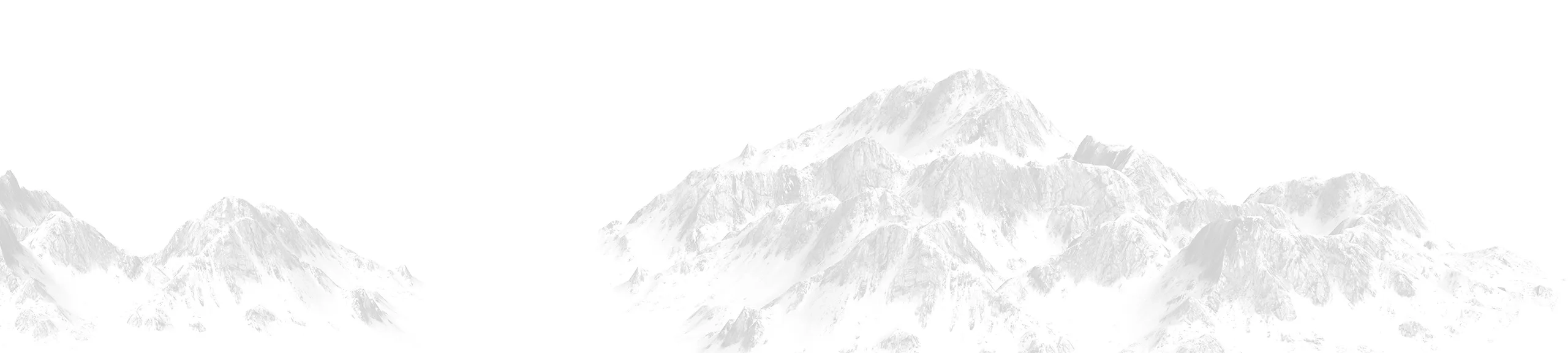
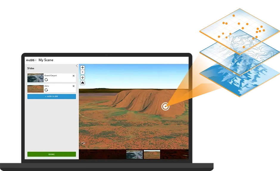
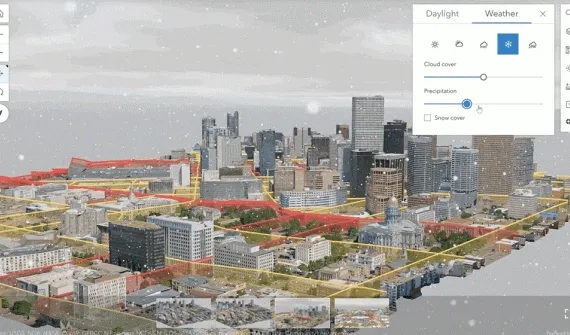
You can use Scene Viewer in ArcGIS Online for viewing, interacting with and authoring your own 3D scenes. Explore 3D features, such as terrain and elevation, add pop-up windows and infographics and combine various 2D and 3D datasets to tell your complete story.  Scene Viewer works with devices that support WebGL, built into most modern browsers for rendering 3D graphics. 
What's new in Scene Viewer Card
What's new in Scene Viewer

The latest June release unleashes unlimited possibilities with more open data support, critical features to create immersive experience, and powerful editing and analysis capabilities. This is a packed release with support of OpenStreetMap 3D scene layers, weather effects and export scene to 360VR.

More

Learn more

Author web scenes in ArcGIS Online Card
Video Author web scenes in ArcGIS Online

Learn how to share 3D content as web scenes directly from your online contents page in ArcGIS Online.

Watch
Mashup 3D content using ArcGIS Online Card
Video Mashup 3D content using ArcGIS Online

Learn how to combine and view content in 3D, save your 3D map view and share it.

Watch
Share web scenes using ArcGIS Pro Card
Video Share web scenes using ArcGIS Pro

Learn how to use ArcGIS Pro as an authoring and publishing tool and gain control over the content you are sharing.

Watch

Subscribe to
Esri Indonesia news

Esri Indonesia | Home

Footer menu

  • Sitemap
  • Privacy
  • Website Terms and Conditions

© 2025 Esri Indonesia All rights reserved.