GIS is empowering agency staff and leaders to integrate diverse types of data to derive understanding, operationalise solutions, share insights, and engage stakeholders and the public.
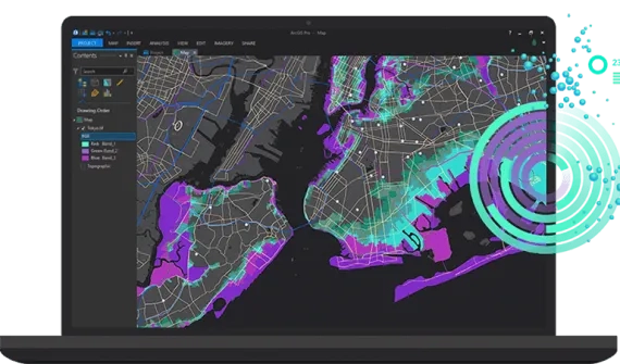
ArcGIS solutions for defence and intelligence
Discover how Esri’s GIS solutions for defence and intelligence deliver advanced mapping and spatial analytics to proactively identify risks and develop effective mitigation and response plans.
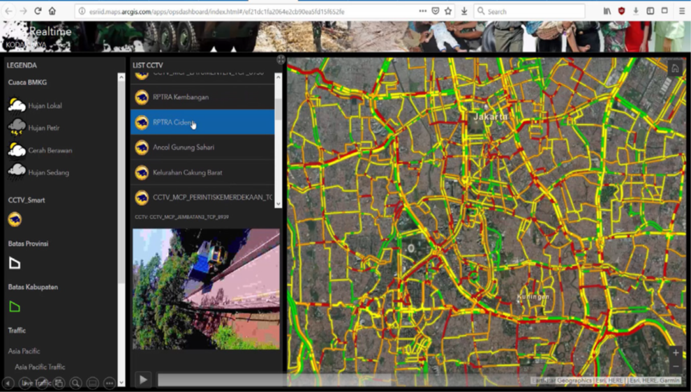
Real-time CCTV and traffic monitoring
Empower stakeholders with the right information and support effective decision-making with real-time, geospatial traffic monitoring.
- Monitor traffic and CCTV feeds in real-time
- Receive alert notifications for traffic jam
- Analyse routes to identify optimal alternatives in the event of traffic jams
Products
- ArcGIS Enterprise (Advanced), including ArcGIS Dashboards
- GeoEvent Server extension for Server
- ArcGIS Desktop or ArcGIS Pro
- Network Analyst extension for Desktop
Required data
- Real-time Traffic Service
- Road Data
- CCTV Service
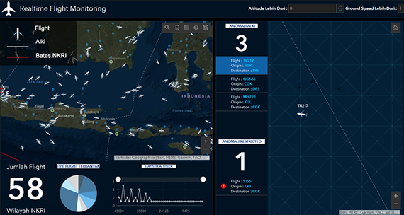
Real-time flight monitoring
Monitor aircraft movements and anomalies in real-time and overlay flight statistical data to provide comprehensive information and drive informed decision-making.
- Real-time flight positioning in Indonesian territories
- Real-time statistical flight information
- Real-time anomaly notification
- Archive historical flight data
Products
- ArcGIS Enterprise advanced, including ArcGIS Dashboards
- GeoEvent Server extension for Server
- ArcGIS Pro on ArcGIS Desktop standard
Required data
- Real-time Flight Service
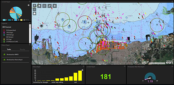
Real-time vessel monitoring
Monitor vessel movements and anomalies in real-time and overlay vessel statistical data to provide comprehensive information and drive informed decision making.
- Real-time vessel positioning in Indonesian territories
- Real-time statistic vessel information
- Real-time anomaly notification
- Archive historical vessel data
Products
- ArcGIS Enterprise advanced, including ArcGIS Dashboards
- GeoEvent Server extension for Server
- ArcGIS Pro on ArcGIS Desktop standard
Required data
- Real-time Vessel Service
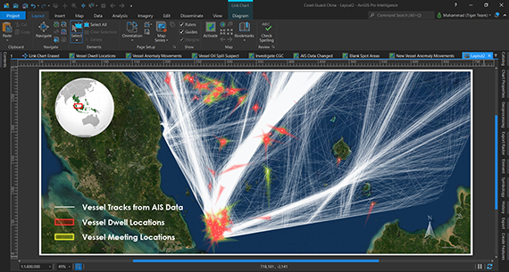
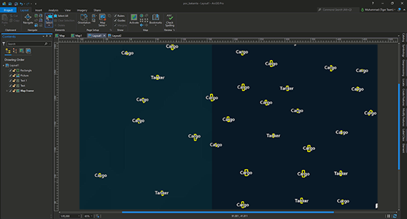
Maritime surveillance intelligence
Analyse data from maritime vessels such as meeting and dwell locations, blank spot areas, suspect interactions, and anomalies in vessel movements, to identify vessels suspected of maritime surveillance.
- Analyse Automatic Identification System (AIS) data
- Identify multiple unique vessel movements over time
- Find locations where vessels are observed with little or no movement over time
- Find blank spots where vessels turn off AIS transponders
- Investigate vessel interactions to understand where the largest number of vessels cross paths or which vessel has the most contact with others
- Identify anomalies in vessel movements and suspect vessels showing AIS data manipulation behaviour
Products
- ArcGIS Enterprise (Advanced)
- ArcGIS GeoEvent Server
- ArcGIS Pro
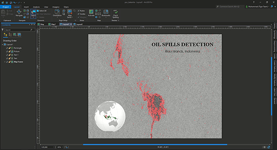
Violation Areas Detection (Oil spills)
Automatically detect oil spill areas to enable quick decision-making, prevent recurrence and enable maritime agencies to respond effectively.
- Utilise free, ready-to-use satellite imagery as base data for analysis
- Monitor violations and incidents with the Automatic Detection System
- Provide high-accuracy results that can be constantly improved
- Scale up to expand monitored areas
Required data:
- Satellite imagery / radar data
Vessel detection and types classification
Leverage GeoAI to generate AIS (Automatic Identification System) data for suspect vessels and enable maritime defence and intelligence agencies to improve incident identification and response.
- Utilise free, out-of-the-box satellite imagery as a base data for vessel detection
- Automate faster detection of individual vessels
- Automate the classification of vessel types according to their dimensions
- Deliver high-accuracy results – and improve outcomes continuously
- Scale up to expand monitored areas
Products
- ArcGIS Enterprise (Advanced)
- ArcGIS Dashboards
- ArcGIS Image Server
- ArcGIS Notebooks extension for Server
- ArcGIS Desktop (Advanced)
- ArcGIS Image Analyst