
GIS is enabling mapping and charting organisations to deliver accurate and authoritative information to stakeholders and to make data-driven decisions.
ArcGIS solutions for mapping and charting
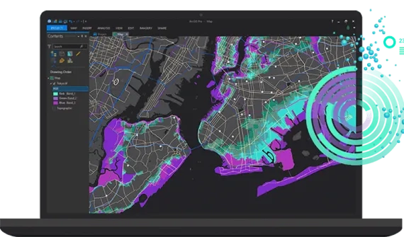
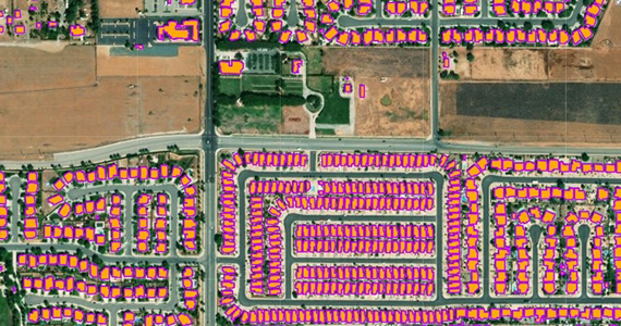
Intelligent Mapping with Geographic Artificial Intelligence (GeoAI)
Combine creative mapping techniques with powerful deep learning tools to automate the creation of authoritative, high-quality maps and geospatial information.
- Use deep learning tools, extract geographic features from raster and remote sensing data
- Build models or scripts to streamline automated feature extraction workflows
- Manage, store, and perform deep learning analytics on imagery
- Automate map production
Products
- ArcGIS Enterprise (Advanced)
- ArcGIS Image Server
- ArcGIS Notebooks
- ArcGIS Pro (Advanced)
- ArcGIS Image Analyst
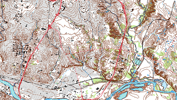
Modern Production Mapping
Collaborate and share information easily to meet the growing demand for authoritative maps and geospatial information.
- Collect and integrate source data and services
- Centralise, manage and secure data, making it accessible across the organization
- Automate the production of multi-resolution data and information products
- Facilitate seamless collaboration and information sharing to enable informed
decision-making
Products
- ArcGIS Enterprise (Advanced)
- Production Mapping for ArcGIS Server
- ArcGIS Pro
- ArcGIS Spatial Analyst
- ArcGIS 3D Analyst
- ArcGIS Production Mapping
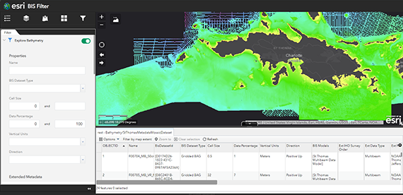
Bathymetry Data Management
Streamline data access and enable quick generation of custom bathymetric surfaces through targeted data selection and prioritisation.
- Streamline data access and enable quick generation of custom bathymetric
surfaces - Visualise multi-resolution and multi-temporal data simultaneously
- Extract data on-the-fly for analysis and eliminate unnecessary duplication
- Create mosaic datasets that can be disseminated as static rasters or published
as image services
Products
- ArcGIS Enterprise (Advanced), including: App Builder for Maritime
- ArcGIS Image Server
- ArcGIS Pro
- ArcGIS for Maritime: Bathymetry
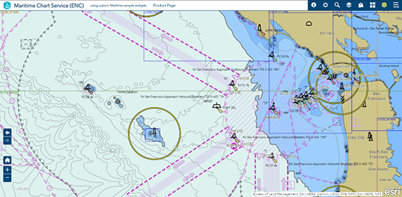
Electronic Navigational Chart (ENC) Data Management
For hydrographic offices, data scientists, non-traditional chart producers, and port authorities - ArcGIS Maritime supports a wide variety of IHO S-57 and S-100 product specifications, including ENC, Inland ENC, AML, S-58, S-4, S-63, and DNC.
- Automate the management, creation, and validation of IHO S-57 and IHO S-100 product specifications
- Validate IHO S-57 Electronic Navigational Charts using the latest IHO S-58 validation standards
- Generate OGC WMS and REST map services directly from the latest electronic charts with the Maritime Chart Service
- Produce vector PDFs for printed paper charts directly from the latest Electronic Navigational Chart data
- Identify anomalies in vessel movements and suspect vessels showing AIS data manipulation behaviour
Products
- ArcGIS Enterprise (Advanced), including: App Builder for Maritime
- ArcGIS Maritime extension
- ArcGIS Pro
- ArcGIS for Maritime: Charting
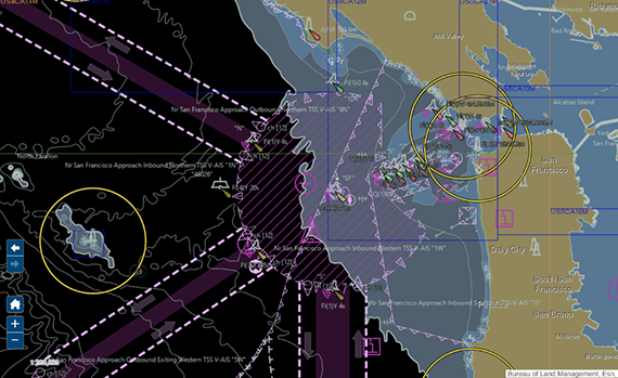
Electronic Navigational Chart (ENC) Data Analytics
Analyse the availability of S-57 or S-100 data for more effective and efficient decision-making.
- Identify individual features and view attribute information
- Change various mariner controls to modify look and feel
- Search individual features based on object name or national object name
Products
- ArcGIS Enterprise (Advanced), including: App Builder for Maritime
- ArcGIS Maritime extension
- ArcGIS Pro
- ArcGIS for Maritime: Charting