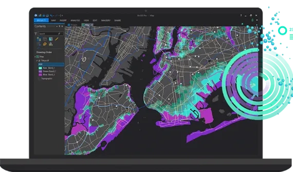
The role of location is key to oil and gas businesses - enabling data-driven decisions, driving network modernisation, improving safety, and streamlining asset management.
ArcGIS solutions for oil & gas
Discover how Esri’s GIS solutions for oil and gas operations deliver advanced mapping and spatial analytics to support daily operations.
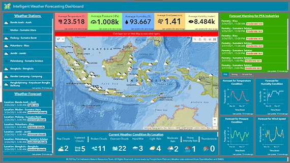
Intelligent Weather Forecasts and Alerting
Access comprehensive information on current weather, trends over time, and forecasts for different locations to support daily operations.
- Improve productivity and planning for weather-related operations
- Maintain safety by accurately aligning planning and forecast data for safer operations
- Avoid excess operational costs by accurately creating workplans
Products
- ArcGIS Enterprise standard (or above) or ArcGIS Online
- ArcGIS Pro standard (or above) for schema design and publishing
- ArcGIS API for Python for automation
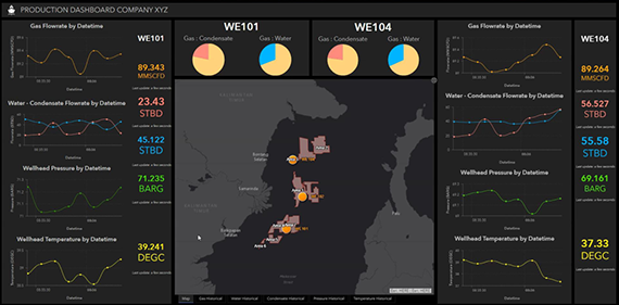
Real-time Asset and Productivity Monitoring
Integrate real-time sensor data from the field with your GIS to monitor asset performance and productivity.
- Monitor field and well performance with dynamic reporting
- Quickly resolve production emergencies
- Reduce operational costs and maintain asset integrity
- Reveal unusual patterns with historical production data
- Make faster decisions with real-time information
Products
- ArcGIS Enterprise standard (or above)
- GeoEvent Server for real-time data monitoring
- ArcGIS Dashboards
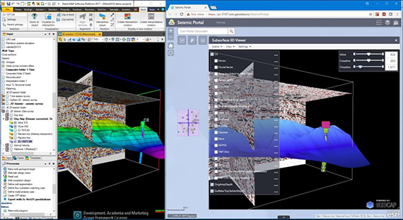
Integration of G&G and GIS Data
Augment your GIS with geological and geophysical data and make it accessible across your organization to enable collaboration and informed decision-making.
- Leverage subsurface modelling and visualization tools
- Simplify data-sharing and collaboration
- Analyze surface and subsurface data
- Enhance data interoperability
Products
- ArcGIS Enterprise standard (or above)
- ArcGIS Pro standard (or above)
- ArcGIS Web AppBuilder
- Geocap Extensions
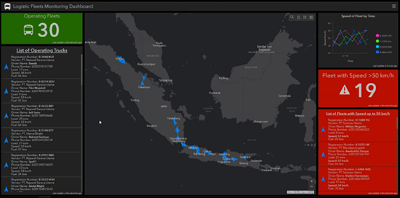
Real-time Fleet Movement Tracking and Monitoring
Analyse fleet routes, fuel consumption and idle time by integrating real-time sensor data with GIS to identify opportunities for optimisation.
- Monitor fleets and other moving assets in real-time
- Receive notifications for speed, over-acceleration, and unsafe driving
- Measure volume, start and destination points, fleet capacity and distance between facilities to optimise schedules
Products
- ArcGIS Enterprise standard (or above) or ArcGIS Online
- ArcGIS GeoEvent Server for real-time data processing
- ArcGIS Pro standard (or above) for schema design and publishing
- ArcGIS Python API for customised reporting
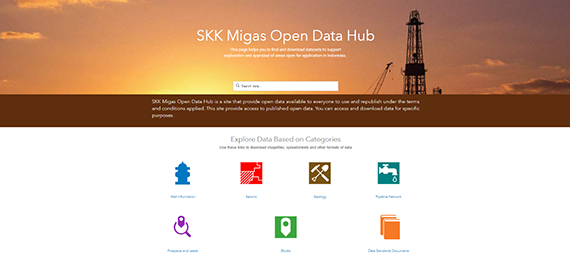
Comprehensive Landing Page for Data Repository
Provide access to accurate, real-time information to facilitate collaboration and improve decision-making.
- Organise people, data, and tools through information-driven initiatives
- Maximise engagement, communication, collaboration, and data sharing
- Leverage existing data and technology and work together with internal and external stakeholders to track progress, improve outcomes, and create vibrant communities
- Share reliable data for better decision-making
Products
- ArcGIS Enterprise standard (or above) or ArcGIS Online
- ArcGIS Sites or ArcGIS Hub
- ArcGIS Web AppBuilder
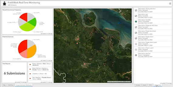
Real-time Fieldworker Management System
Leverage the power of location to improve coordination and operational efficiency in field workforce activities.
- Access real-time trusted data both in the field and in the office
- Simplify task-dispatching workflows
- Facilitate field data collection and submission via mobile devices
- Improve data accuracy and avoid costly errors
Products
- ArcGIS Enterprise standard (or above) or ArcGIS Online
- ArcGIS Workforce for task dispatching
- ArcGIS Survey123 for field data collection
- ArcGIS Dashboards
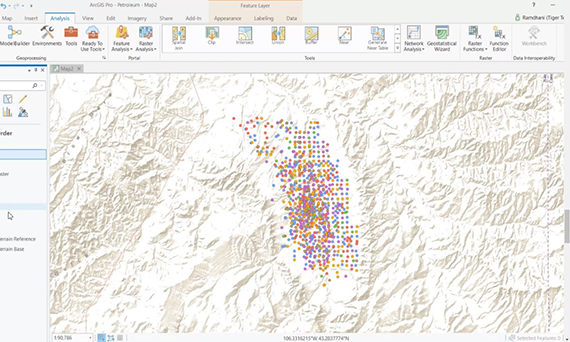
Productivity Visualisation and Analysis
Analyse oil well operational data and reveal valuable insights to support data-driven decision-making.
- Integrate operational data with location and business intelligence
- Create advanced and comprehensive visualisations
- Run statistical analysis for asset productivity
- Deliver insights for asset maintenance plans
Products
- ArcGIS Enterprise standard (or above)
- ArcGIS Pro standard (or above)
- ArcGIS Insights
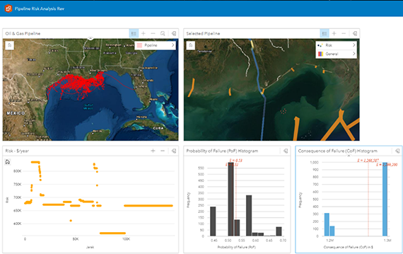
Pipeline Risk Analysis with Business Intelligence
Use GIS-based business intelligence to analyze pipeline failure risks and roll out mitigation plans for high-risk areas.
- Combine spatial and business data for analysis of failure risks
- Create advanced and comprehensive visualizations
- Run statistical analysis on pipeline risk assessments
- Implement early mitigation to prevent asset failure
Products
- ArcGIS Pro standard (or above)
- ArcGIS Enterprise standard (or above) or ArcGIS Online
- ArcGIS Insights
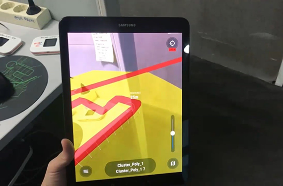
Augmented Reality for Underground Asset Inspection
Use augmented reality (AR) and GIS technology to empower fieldworkers to visualise underground utilities.
- Simplify asset inspections and measurements
- Ensure safer excavation practices
- Reduce asset monitoring costs
Products
- ArcGIS Enterprise standard (or above) or ArcGIS Online
- ArcGIS Pro standard (or above) for schema design and publishing
- vGIS Portal
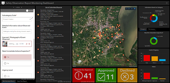
Safety Observation Reporting System
Enable incident reporting in the field with digital forms and maintain an overall view of safety violations with a simple and effective HSE management system.
- Easily report and submit observed safety incidents on a mobile device, anywhere, at any time
- Real-time monitoring of reported events for faster decision-making
- Reduce risk to personnel and assets
Products
- ArcGIS Enterprise standard (or above) or ArcGIS Online
- ArcGIS Survey123 (Survey123 Connect and Survey123 Mobile App)
- ArcGIS Dashboards
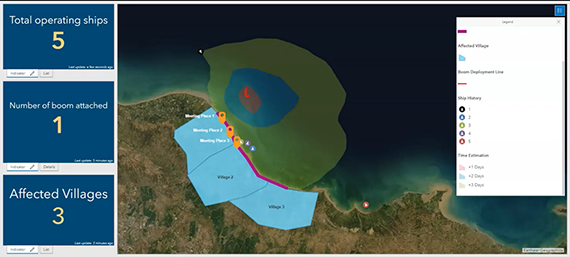
GIS-based Common Operation Picture for Oil Spill Response
Leverage a centralised emergency management system to monitor and assess
oil spills as they happen.
- Visualise oil spill areas and collaborate with stakeholders on response plans
- Maintain situational awareness with up-to-date information
- Access a single source of data to identify effective and appropriate responses
Products
- ArcGIS Enterprise standard (or above)
- ArcGIS GeoEvent Server for real-time data streams
- ArcGIS Dashboards
- ArcGIS Survey123
- ArcGIS Workforce
- ArcGIS Image Server (optional, for aerial imagery management)


