You are here News and events Esri Indonesia blog Esri Indonesia blog Why organizations that connect AI with location intelligence gain a decisive advantage Organizations today are operating in an environment defined by constant change and escalating uncertainty. Climate extremes now disrupt specific facilities rather than entire regions. Global supply chains can be thrown off balance by a single congested port. Cyber threats increasingly target precise networks and infrastructure nodes. What these risks have in common is simple yet often underestimated. Learn more What's leaving in ArcGIS Enterprise 12.0? Learn which legacy apps are being retired and how moving to Experience Builder and Instant Apps can streamline your GIS workflows. Learn more Transforming regional planning in Yogyakarta: A model for smarter governance Yogyakarta’s Land and Spatial Planning Service leverages GIS mapping for faster land registration, accurate zoning, real-time land-use monitoring, and better disaster management, enabling effective regional planning, improved public services, and sustainable urban growth. Learn more How remote sensing is transforming decision making Discover how satellites, drones, and AI are helping organizations make smarter, faster decisions across agriculture, mining, urban planning, and disaster response. Learn more Kuasai ArcGIS Enterprise 11.5 sebelum melompat ke 12 Sebagai rilis terakhir seri 11.x, upgrade ini adalah basis penting secara struktural mendukung transisi ke genari Enterprise baru. Learn more ArcGIS Enterprise 11.5: Prepare for version 12 Stay ahead by learning what’s new in ArcGIS Enterprise 11.5 and prepare your upgrade with ease. Learn more ArcGIS user types: What you need to know The June 2024 ArcGIS Online update introduced several new features and capabilities, most importantly, the new user type licensing model that streamlines administration workflows and expands current user roles. Learn more PLN innovates network vulnerability assessment with GIS Discover how PLN utilizes GIS to gain valuable insights from analysis results, maps, and dashboards, enabling them to take preventive or corrective actions to minimize the risk of disruptions or system failures. Learn more Tracking sustainability with smart maps Committed to reducing the impact of its mining activities in Senegal, France's Eramet leverages geospatial technology to make decisions across its mineral sand's operation. Learn more Cloud transformation: Powering tomorrow’s success As GIS systems continues to grow in complexity and importance, how can organisations keep up? The answer may lie in the cloud. Learn more Enhancing Langsa restoration with location insights With a primary focus on securing the Langsa wells and devising new strategies for data acquisition, using GIS technology, Pertamina to build a foundation for data integration, analysis, and visualization. Learn more Digitizing exploration practices towards sustainability Find out how DigiSHEC digitally transformed OZ Minerals' (now BHP) exploration project lifecycle management, winning three awards in 2023, in Australia. Learn more Nawasena: Managing Kideco's land bank Discover Kideco's award-winning project redefining land bank management with spatial analytics. Learn more Plugging Indonesia’s IHDC into the global geospatial ecosystem Addressing the growing demand for hydrographic data, Pushidrosal empowers the nation’s maritime development by leveraging geospatial technology through IHDC. Learn more Demand prediction with machine learning Turkey's mobile service provider, Turkcell, takes a surgical approach to understanding where its future demand will be coming from. Learn more An EYSA winner's pandemic journey As a participant of the first virtual Esri Young Scholar Award, Esri Indonesia's 2020 winner Anandika Dian Pramesti shares how this experience gave her a deeper appreciation for GIS technology. Learn more Enabling sustainable mining production with geospatial technology In this special Q&A with mining industry leaders, explore how geospatial technology can be used to sustain mining production and support economic recovery. Learn more Sustaining oil and gas production for economic recovery Get insights on how resources organizations can leverage geospatial technology to meet the unprecedented challenges presented by COVID-19 in this Q&A with industry leaders. Learn more Tapping into geothermal, Indonesia reduces reliance on fossil fuels Pertamina Geothermal Energy applies GIS through many phases of operation, from exploration, development, and reservoir management to operational oversight. Learn more Digitalising navigational charts for safety NOAA is leading the world in phasing out paper charts, embracing the advantages of Electronic Navigational Charts. Learn more Nespresso's GIS formula: Addressing business challenges and environmental sustainability Coffee icon Nespresso has discovered a compelling link between corporate citizenship and profitable business - and communicates these important insights using maps. Learn more Citizen engagement drives the next phase of smart cities The traditional roles of government, businesses and citizens are evolving as smart city initiatives tap into the collective intelligence of empowered citizens. Learn more Crowd-sourced data helps WA government improve road safety The Western Australia state government is leveraging data captured by members of the community to assist with road safety planning aimed at reducing road fatalities. Learn more How to use drones in emergency response When it comes to emergency response, drones are changing the way organisations operate - going where people can't to collect and capture critical data from dangerous locations. Learn more
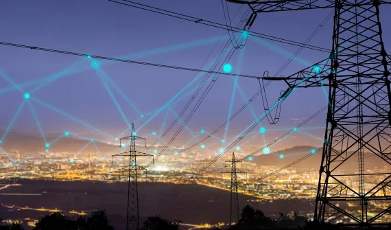
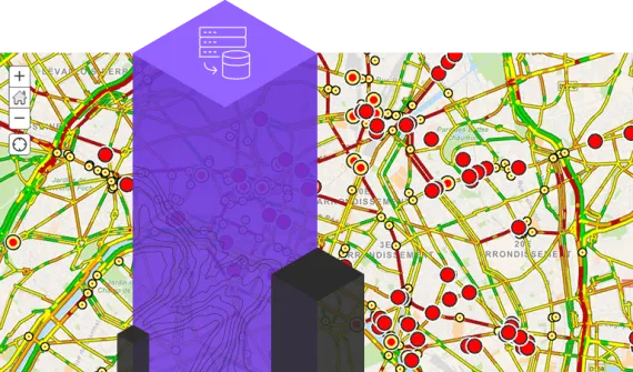
Why organizations that connect AI with location intelligence gain a decisive advantage Organizations today are operating in an environment defined by constant change and escalating uncertainty. Climate extremes now disrupt specific facilities rather than entire regions. Global supply chains can be thrown off balance by a single congested port. Cyber threats increasingly target precise networks and infrastructure nodes. What these risks have in common is simple yet often underestimated. Learn more
What's leaving in ArcGIS Enterprise 12.0? Learn which legacy apps are being retired and how moving to Experience Builder and Instant Apps can streamline your GIS workflows. Learn more
Transforming regional planning in Yogyakarta: A model for smarter governance Yogyakarta’s Land and Spatial Planning Service leverages GIS mapping for faster land registration, accurate zoning, real-time land-use monitoring, and better disaster management, enabling effective regional planning, improved public services, and sustainable urban growth. Learn more
How remote sensing is transforming decision making Discover how satellites, drones, and AI are helping organizations make smarter, faster decisions across agriculture, mining, urban planning, and disaster response. Learn more
Kuasai ArcGIS Enterprise 11.5 sebelum melompat ke 12 Sebagai rilis terakhir seri 11.x, upgrade ini adalah basis penting secara struktural mendukung transisi ke genari Enterprise baru. Learn more
ArcGIS Enterprise 11.5: Prepare for version 12 Stay ahead by learning what’s new in ArcGIS Enterprise 11.5 and prepare your upgrade with ease. Learn more
ArcGIS user types: What you need to know The June 2024 ArcGIS Online update introduced several new features and capabilities, most importantly, the new user type licensing model that streamlines administration workflows and expands current user roles. Learn more
PLN innovates network vulnerability assessment with GIS Discover how PLN utilizes GIS to gain valuable insights from analysis results, maps, and dashboards, enabling them to take preventive or corrective actions to minimize the risk of disruptions or system failures. Learn more
Tracking sustainability with smart maps Committed to reducing the impact of its mining activities in Senegal, France's Eramet leverages geospatial technology to make decisions across its mineral sand's operation. Learn more
Cloud transformation: Powering tomorrow’s success As GIS systems continues to grow in complexity and importance, how can organisations keep up? The answer may lie in the cloud. Learn more
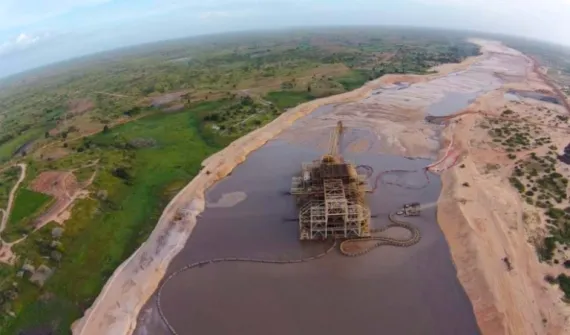
Enhancing Langsa restoration with location insights With a primary focus on securing the Langsa wells and devising new strategies for data acquisition, using GIS technology, Pertamina to build a foundation for data integration, analysis, and visualization. Learn more
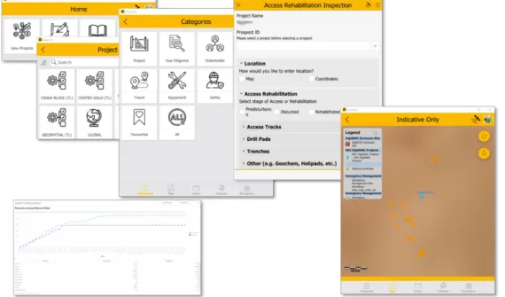
Digitizing exploration practices towards sustainability Find out how DigiSHEC digitally transformed OZ Minerals' (now BHP) exploration project lifecycle management, winning three awards in 2023, in Australia. Learn more
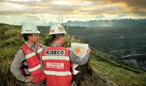
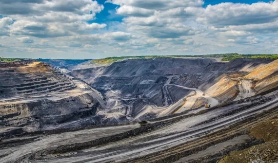
Nawasena: Managing Kideco's land bank Discover Kideco's award-winning project redefining land bank management with spatial analytics. Learn more
Plugging Indonesia’s IHDC into the global geospatial ecosystem Addressing the growing demand for hydrographic data, Pushidrosal empowers the nation’s maritime development by leveraging geospatial technology through IHDC. Learn more
Demand prediction with machine learning Turkey's mobile service provider, Turkcell, takes a surgical approach to understanding where its future demand will be coming from. Learn more
An EYSA winner's pandemic journey As a participant of the first virtual Esri Young Scholar Award, Esri Indonesia's 2020 winner Anandika Dian Pramesti shares how this experience gave her a deeper appreciation for GIS technology. Learn more
Enabling sustainable mining production with geospatial technology In this special Q&A with mining industry leaders, explore how geospatial technology can be used to sustain mining production and support economic recovery. Learn more
Sustaining oil and gas production for economic recovery Get insights on how resources organizations can leverage geospatial technology to meet the unprecedented challenges presented by COVID-19 in this Q&A with industry leaders. Learn more
Tapping into geothermal, Indonesia reduces reliance on fossil fuels Pertamina Geothermal Energy applies GIS through many phases of operation, from exploration, development, and reservoir management to operational oversight. Learn more
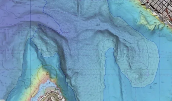
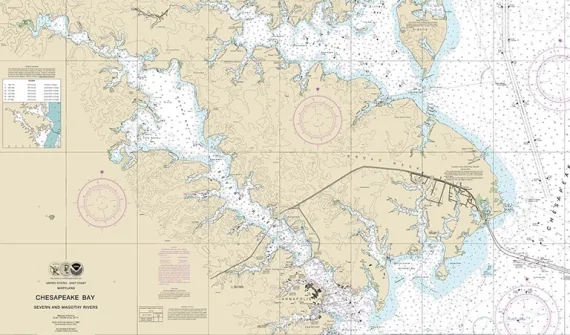
Digitalising navigational charts for safety NOAA is leading the world in phasing out paper charts, embracing the advantages of Electronic Navigational Charts. Learn more
Nespresso's GIS formula: Addressing business challenges and environmental sustainability Coffee icon Nespresso has discovered a compelling link between corporate citizenship and profitable business - and communicates these important insights using maps. Learn more
Citizen engagement drives the next phase of smart cities The traditional roles of government, businesses and citizens are evolving as smart city initiatives tap into the collective intelligence of empowered citizens. Learn more
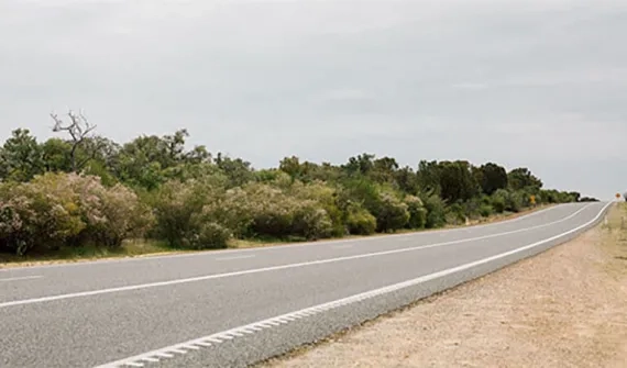
Crowd-sourced data helps WA government improve road safety The Western Australia state government is leveraging data captured by members of the community to assist with road safety planning aimed at reducing road fatalities. Learn more
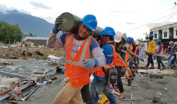
How to use drones in emergency response When it comes to emergency response, drones are changing the way organisations operate - going where people can't to collect and capture critical data from dangerous locations. Learn more