You are here News and events Esri Indonesia blog Esri Indonesia blog Sustaining oil and gas production for economic recovery Get insights on how resources organizations can leverage geospatial technology to meet the unprecedented challenges presented by COVID-19 in this Q&A with industry leaders. Learn more Tapping into geothermal, Indonesia reduces reliance on fossil fuels Pertamina Geothermal Energy applies GIS through many phases of operation, from exploration, development, and reservoir management to operational oversight. Learn more Digitalisasi peta navigasi untuk keamanan NOAA menjadi pelopor dunia dalam memanfaatkan Peta Navigasi Elektronik, dan meninggalkan peta kertas. Learn more Digitalising navigational charts for safety NOAA is leading the world in phasing out paper charts, embracing the advantages of Electronic Navigational Charts. Learn more Penggunaan GIS oleh Nespresso: Mengatasi berbagai tantangan bisnis dan kelestarian lingkungan Nespresso, sebuah ikon di dalam industri kopi, telah menemukan hubungan yang menarik antara pemberdayaan masyarakat dan bisnis yang menguntungkan - serta mengomunikasikan wawasan ini menggunakan peta. Learn more Nespresso's GIS formula: Addressing business challenges and environmental sustainability Coffee icon Nespresso has discovered a compelling link between corporate citizenship and profitable business - and communicates these important insights using maps. Learn more 8 hal yang dapat dipelajari dari transformasi digital SIG BP Dengan anggaran yang kecil serta bantuan dari lima orang untuk mulai mengembangkan platform in, BP mampu menerapkan SIG berskala enterprise global yang dapat menghasilkan kolaborasi yang lebih baik, insight yang lebih luas, serta pengambilan keputusan lebih cepat. Learn more Hal yang harus Anda ketahui terkait virus corona Chief Medical Officer Esri Dr. Este Geraghty membagikan informasi terbaru dan terpercaya terkait COVID-19 sebagai upaya persiapan selama masa krisis. Learn more Coronavirus: What you need to know Esri's Chief Medical Officer - Dr. Este Geraghty - shares a collection of the most up-to-date and authoritative resources on COVID-19 to help you stay informed and prepared during this emergency. Learn more 8 lessons from BP's global GIS digital transformation With a small budget and only five people working to start the platform, BP implemented a global enterprise GIS that enables greater collaboration, deeper insights and faster decision making. Learn more A transformation journey for the City of Cockburn Follow the City of Cockburn's transformation journey to become the most attractive place to live, work, visit and invest in Perth. Learn more Citizen engagement drives the next phase of smart cities The traditional roles of government, businesses and citizens are evolving as smart city initiatives tap into the collective intelligence of empowered citizens. Learn more Crowd-sourced data helps WA government improve road safety The Western Australia state government is leveraging data captured by members of the community to assist with road safety planning aimed at reducing road fatalities. Learn more GIS the catalyst for digital transformation of local government As early adopters of GIS technology, local governments are leading the push for more open, mobile, and data-driven organisations. Learn more How to use drones in emergency response When it comes to emergency response, drones are changing the way organisations operate - going where people can't to collect and capture critical data from dangerous locations. Learn more
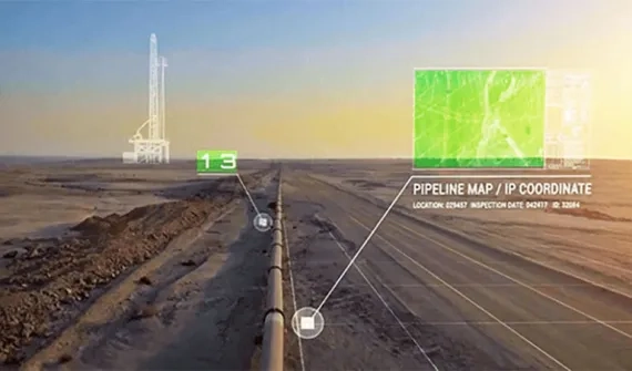
Sustaining oil and gas production for economic recovery Get insights on how resources organizations can leverage geospatial technology to meet the unprecedented challenges presented by COVID-19 in this Q&A with industry leaders. Learn more
Tapping into geothermal, Indonesia reduces reliance on fossil fuels Pertamina Geothermal Energy applies GIS through many phases of operation, from exploration, development, and reservoir management to operational oversight. Learn more
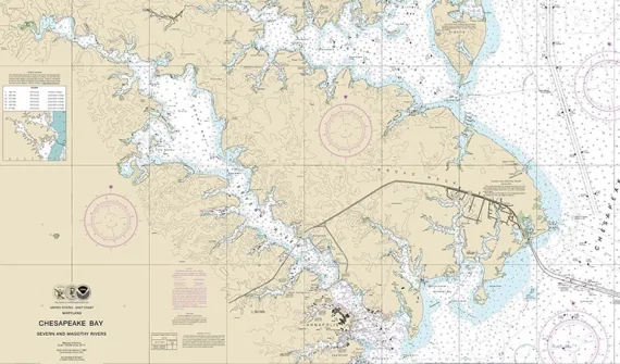
Digitalisasi peta navigasi untuk keamanan NOAA menjadi pelopor dunia dalam memanfaatkan Peta Navigasi Elektronik, dan meninggalkan peta kertas. Learn more
Digitalising navigational charts for safety NOAA is leading the world in phasing out paper charts, embracing the advantages of Electronic Navigational Charts. Learn more
Penggunaan GIS oleh Nespresso: Mengatasi berbagai tantangan bisnis dan kelestarian lingkungan Nespresso, sebuah ikon di dalam industri kopi, telah menemukan hubungan yang menarik antara pemberdayaan masyarakat dan bisnis yang menguntungkan - serta mengomunikasikan wawasan ini menggunakan peta. Learn more
Nespresso's GIS formula: Addressing business challenges and environmental sustainability Coffee icon Nespresso has discovered a compelling link between corporate citizenship and profitable business - and communicates these important insights using maps. Learn more
8 hal yang dapat dipelajari dari transformasi digital SIG BP Dengan anggaran yang kecil serta bantuan dari lima orang untuk mulai mengembangkan platform in, BP mampu menerapkan SIG berskala enterprise global yang dapat menghasilkan kolaborasi yang lebih baik, insight yang lebih luas, serta pengambilan keputusan lebih cepat. Learn more
Hal yang harus Anda ketahui terkait virus corona Chief Medical Officer Esri Dr. Este Geraghty membagikan informasi terbaru dan terpercaya terkait COVID-19 sebagai upaya persiapan selama masa krisis. Learn more
Coronavirus: What you need to know Esri's Chief Medical Officer - Dr. Este Geraghty - shares a collection of the most up-to-date and authoritative resources on COVID-19 to help you stay informed and prepared during this emergency. Learn more
8 lessons from BP's global GIS digital transformation With a small budget and only five people working to start the platform, BP implemented a global enterprise GIS that enables greater collaboration, deeper insights and faster decision making. Learn more
A transformation journey for the City of Cockburn Follow the City of Cockburn's transformation journey to become the most attractive place to live, work, visit and invest in Perth. Learn more
Citizen engagement drives the next phase of smart cities The traditional roles of government, businesses and citizens are evolving as smart city initiatives tap into the collective intelligence of empowered citizens. Learn more
Crowd-sourced data helps WA government improve road safety The Western Australia state government is leveraging data captured by members of the community to assist with road safety planning aimed at reducing road fatalities. Learn more
GIS the catalyst for digital transformation of local government As early adopters of GIS technology, local governments are leading the push for more open, mobile, and data-driven organisations. Learn more
How to use drones in emergency response When it comes to emergency response, drones are changing the way organisations operate - going where people can't to collect and capture critical data from dangerous locations. Learn more