
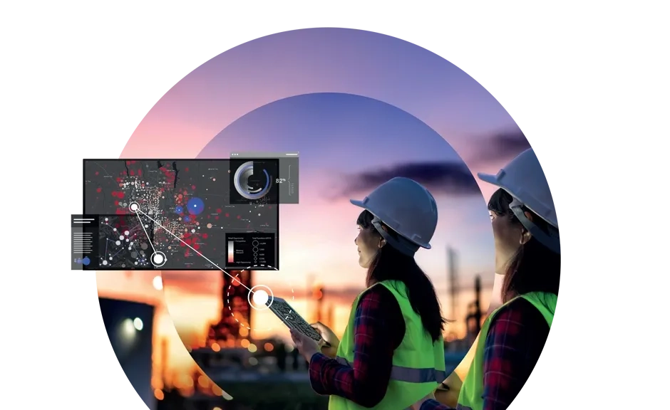
Imagery and remote sensing provide accurate insights by capturing, processing, and analyzing data from the Earth’s surface. From high-resolution satellite imagery to drone-based remote sensing, these technologies deliver the information needed to make smarter, data-driven decisions.
Turning data into insight: An overview of imagery workflow
Step 1 - Data capture
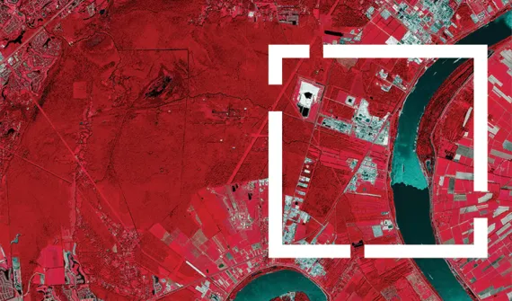
Satellites, drones, and sensors capture visible, hyperspectral, and multispectral data for detailed Earth surface insights.
Step 2 - Data processing
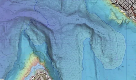
Raw imagery is enhanced with geometric corrections, calibration, and LiDAR mapping to ensure precision and reliability.
Step 3 - Analysis and modeling
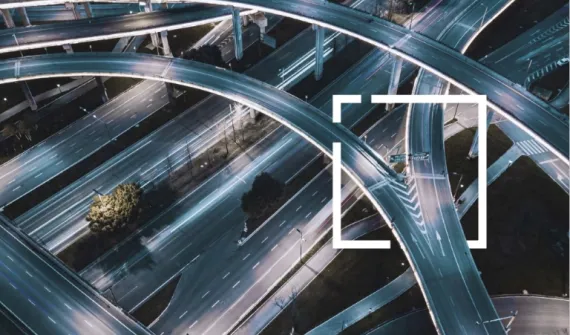
Spatial tools analyze imagery for monitoring, planning, and risk management, producing 2D maps, 3D models, and digital twins.
Step 4 - GIS integration
Insights integrate seamlessly into ArcGIS to visualize patterns, track changes over time, and support real-time decision-making.
Ready to explore what's possible? Book a demo today to discover how imagery and remote sensing in GIS can transform your workflows.
Key benefits of GIS imagery and remote sensing
Whether you’re optimizing infrastructure, monitoring the environment, or improving asset management, Esri’s imagery and remote sensing tools deliver:

Actionable insights
Monitor land use, environmental change, and infrastructure with satellite and drone imagery in real time.

Scalable solutions
Apply GIS imagery analysis to small projects or enterprise-scale operations with flexible, customizable tools.
Advanced technologies
Leverage high-resolution imagery, LiDAR mapping, hyperspectral and multispectral data for deeper spatial analysis.
See imagery capabilities in action
Ready to learn more? Contact us to learn how you can manage large volumes of imagery and remotely-sensed data.
FAQ
- What is reality mapping, and how does it benefit various industries?
Reality mapping uses advanced geospatial technologies like satellite imagery, drone mapping, and Light Detection and Ranging (LiDAR) to create accurate, real-time visualizations of infrastructure and surrounding environments. This technology helps monitor performance, identify potential risks, and plan maintenance and expansions with greater precision. With real-time insights, your team can respond faster and more effectively to emerging challenges.
- How can Esri’s remote sensing tools help with risk management?
Esri’s remote sensing solutions use high-resolution satellite imagery, LiDAR, and drone data to monitor various environmental factors and pinpoint risk-prone areas. These tools enable real-time mapping and predictive modeling, helping organizations proactively manage risks and reduce damage from extreme events. You can stay ahead of potential disasters and mitigate impacts before they occur.
- What types of assets can Esri’s technology monitor?
Esri’s reality mapping technology can monitor a wide range of assets, including infrastructure, land, and environmental features. By providing detailed visualizations and data on asset conditions, you can schedule maintenance more efficiently, prevent unplanned outages, and ensure optimal performance across your entire network.
- What is LiDAR, and why is it important for various industries?
LiDAR (Light Detection and Ranging) is a remote sensing technology that uses laser light to create highly accurate 3D models of terrain and infrastructure. Across industries, LiDAR is invaluable for infrastructure planning, risk assessment, and detecting topographical changes that could affect resources.
- How quickly can I implement Esri’s Imagery & Remote Sensing solutions?
Esri’s solutions are built to be scalable and flexible, so they can integrate with your existing systems quickly and efficiently. Our experts work with you to ensure a seamless deployment tailored to your specific needs.