You are here News and events News News Search news Search by year All202320222021202020192018201720162015201420132012 Tags - Any -3DABSEventsLand AdministrationAECAgileAgribusinessAgricultureWaterfallLocation-based analyticsBig Data AnalyticsGeospatial AnalyticsUrban analyticsPredictive analysisReal-time analyticsTransport analyticsAnalyticsData analyticsAppsMobile applicationsAppStudioArcGISArcGIS 10.5ArcGIS 10.6ArcGIS EnterpriseArcGIS HubArcGIS IndoorsArcGIS OnlineArcGIS ProArtificial intelligenceAsset managementInsuranceInsurance and BankingAugmented realityAustralian Bureau of StatisticsAutodeskBankingBIBig DataBIMBusinessBorder PatrolBusiness IntelligenceCadastreCalifornia CoastlineCitizen engagementClean energyCloudCloud computingCloud GISCollectorCommercialCommercial propertyCommunityContentCoronavirusCouncilCOVID-19Crisis CrowdsourcingDataRaster dataData visualisationDeep learningDefence and intelligenceDekhoDesignSpeculative designDigital constructionDigital engineeringDigital transformationDisruptive appsDronesResourcesEducationGreen economyeLearningElectionElectorateElectricElectricityEmergency managementEmergency responseEmergency servicesEnergyRenewable energyEnergy, oil, gas and renewablesEngineeringEnterprise GISENVIEnvironmental managementEsriEsri AustraliaEsri Petroleum ConferenceEsri UCEsri Young Scholar AwardEsri Young Scholars AwardFederal governmentFinancial institutionsFinancial servicesFood securityForestryGasGDA2020GDA94Geo hubGeoAIGeoAnalyticsGeoBIMGeographic datumGeographic Information SystemsGeospatialGeothermalSolar eclipseGISGIS for schoolsGIS in miningGIS in national government GIS in oil and gasGIS managerGIS server softwareGIS technologyGIS web servicesGovernmentMount AgungHealthHealth and human servicesHomeland SecurityIcon WaterIDLImageryImpact AwardsIndoor navigationPetroleumTransport and InfrastructureInnovationInsights for ArcGISLocation intelligenceOperational intelligenceInteractive mapsInternet of ThingsInternshipInteroperabilityIoTJack DangermondUtility networkJavaScriptNational SecurityPublic safetyPartnershipKerajaan Negeri SembilanOperational awarenessOH&SSmart communitiesSafe communitiesLand managementLaura DangermondLaw enforcementLive dataLive sensorsLocal governmentLogisticsMachine learningSupply chain managementMapping and chartingMapsMaritimeResilient communitiesMediaMicrosoft AzureMiningMining explorationOilOil & gasMobileMobile GISNational developmentNot for profitOpen dataOpen platformOz MineralsOzriUnited NationsPortsTrainingSustainable developmentState governmentSite ScanSAR ImagerySatellite imagerySAG AwardsRemote sensingPlanningUrban planningPERHAPIUnmanned Aerial VehiclesPETRONASProductsPublic sectorQueensland GlobeRetailUser researchROISaaSSabah Lands and Surveys DepartmentSAPSARscapeSensorsSmart transportSmart citiesSmarterWXSpatial data infrastructure solutionsStartupsStory mapsWaterSurvey123TelcoTelecommunicationsTransformationTransportTransportationTSFUIUnearthed ChallengeUser experienceUser interfaceUtilitiesUXUXGVirtual realityWeb GISWHO Smart mapping technology can boost local government revenue, says expert State-of-the-art smart mapping technology can help local governments across the country increase their revenues and create next-generation services, according to local news agency Detik.com. Learn more Demand for smart mapping skill sets soars in Indonesia Several of the country's most respected universities have signed a landmark agreement with leading geospatial solutions provider Esri Indonesia to provide students with broad access to advanced smart mapping technology. Learn more Smart mapping technology to take STEM education to new heights State-of-the-art smart mapping technology is being used by students at Kranji Secondary School to pinpoint interesting elements that make Kampong Glam a tourist destination. Learn more News Major technology release steps smart mapping into new dimension The way the world uses smart mapping technology has changed today, with the release of the most advanced Geographic Information System (GIS) platform ever developed. Learn more News Malaysia's national ICT R&D agency partners with Esri to boost national security MIMOS, Esri Inc. and Esri Malaysia have signed a memorandum of understanding that will bring the government's R&D efforts in the field of national security to new heights. Learn more News Halloween cemetery tour starring history's most notorious Should the dead rise today, which famous person would be on top of your list to meet? Learn more News JUPEM recognised internationally for innovative use of mapping technology BGSP has been selected from more than 400,000 organisations worldwide to win a global Special Achievement in GIS (SAG) Award. Learn more News Pertamina EP receives international recognition for smart mapping tool State-owned oil and natural gas corporation Pertamina EP has been selected from more than 400,000 organisations worldwide to win a Special Achievement in GIS (SAG) award. Learn more Tan Tock Seng Hospital to improve patient care with smart mapping technology Learn more Advanced geospatial technology to revolutionise national security Learn more New technology to future-proof Iskandar Malaysia Iskandar Regional Development Authority (IRDA) is using state of the art technology to transform the region into Malaysia's next economic powerhouse. Learn more Learn more Learn more Learn more Learn more Learn more Geotriggered notifications provide retailers with a competitive edge Learn more Learn more NUS student's urban planning project wins nationwide competition Learn more Mapping technology to give Asia's SCM industry world-class capabilities Learn more Load More
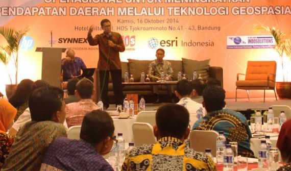
Smart mapping technology can boost local government revenue, says expert State-of-the-art smart mapping technology can help local governments across the country increase their revenues and create next-generation services, according to local news agency Detik.com. Learn more
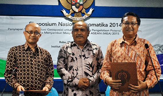
Demand for smart mapping skill sets soars in Indonesia Several of the country's most respected universities have signed a landmark agreement with leading geospatial solutions provider Esri Indonesia to provide students with broad access to advanced smart mapping technology. Learn more
Smart mapping technology to take STEM education to new heights State-of-the-art smart mapping technology is being used by students at Kranji Secondary School to pinpoint interesting elements that make Kampong Glam a tourist destination. Learn more
News Major technology release steps smart mapping into new dimension The way the world uses smart mapping technology has changed today, with the release of the most advanced Geographic Information System (GIS) platform ever developed. Learn more
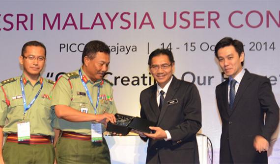
News Malaysia's national ICT R&D agency partners with Esri to boost national security MIMOS, Esri Inc. and Esri Malaysia have signed a memorandum of understanding that will bring the government's R&D efforts in the field of national security to new heights. Learn more
News Halloween cemetery tour starring history's most notorious Should the dead rise today, which famous person would be on top of your list to meet? Learn more
News JUPEM recognised internationally for innovative use of mapping technology BGSP has been selected from more than 400,000 organisations worldwide to win a global Special Achievement in GIS (SAG) Award. Learn more
News Pertamina EP receives international recognition for smart mapping tool State-owned oil and natural gas corporation Pertamina EP has been selected from more than 400,000 organisations worldwide to win a Special Achievement in GIS (SAG) award. Learn more
New technology to future-proof Iskandar Malaysia Iskandar Regional Development Authority (IRDA) is using state of the art technology to transform the region into Malaysia's next economic powerhouse. Learn more